Categories
Features National Parks Poetry The Great Outdoors

The Allure of Big Sur: Why This Slice of California’s Coastal Wilderness Has Captured Artists’ Imaginations for Generations

Big Sur is not so much a destination as a state of mind. The landscape and wildlife speak to the naturalist in every soul who visits there.

For decades, people have journeyed to Big Sur seeking inspiration and communion in this magnificent natural cathedral. Time spent exploring along the coast or trekking through the mountains or roaming among the redwoods or simply laying back in harmony with the surroundings is a sojourn for body, mind, and spirit.

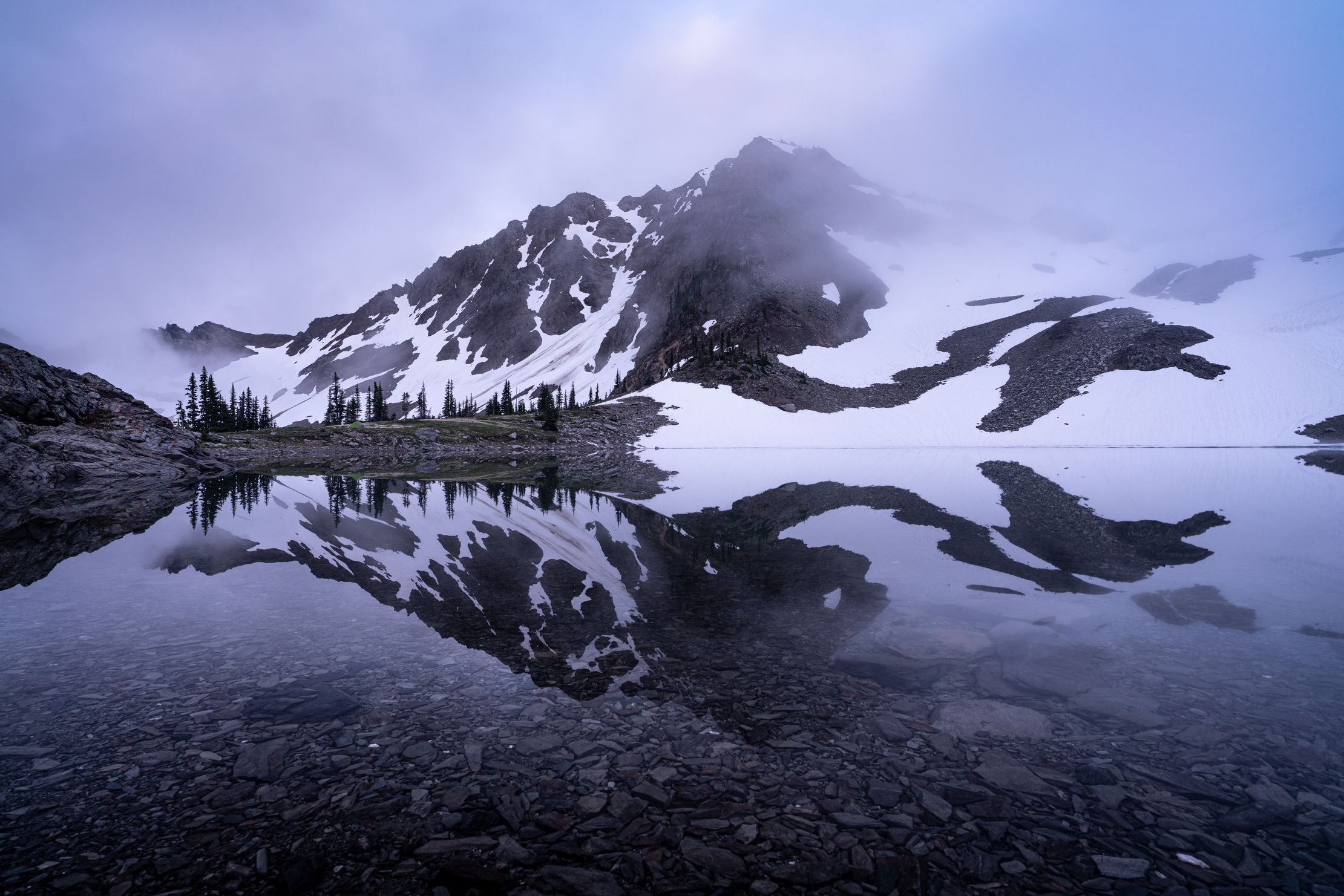
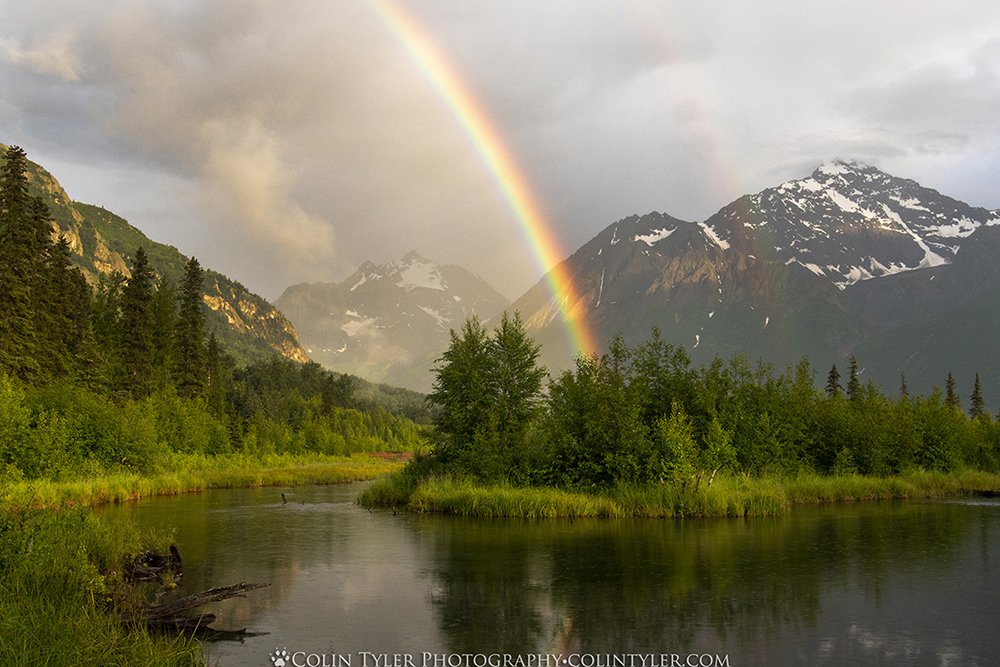
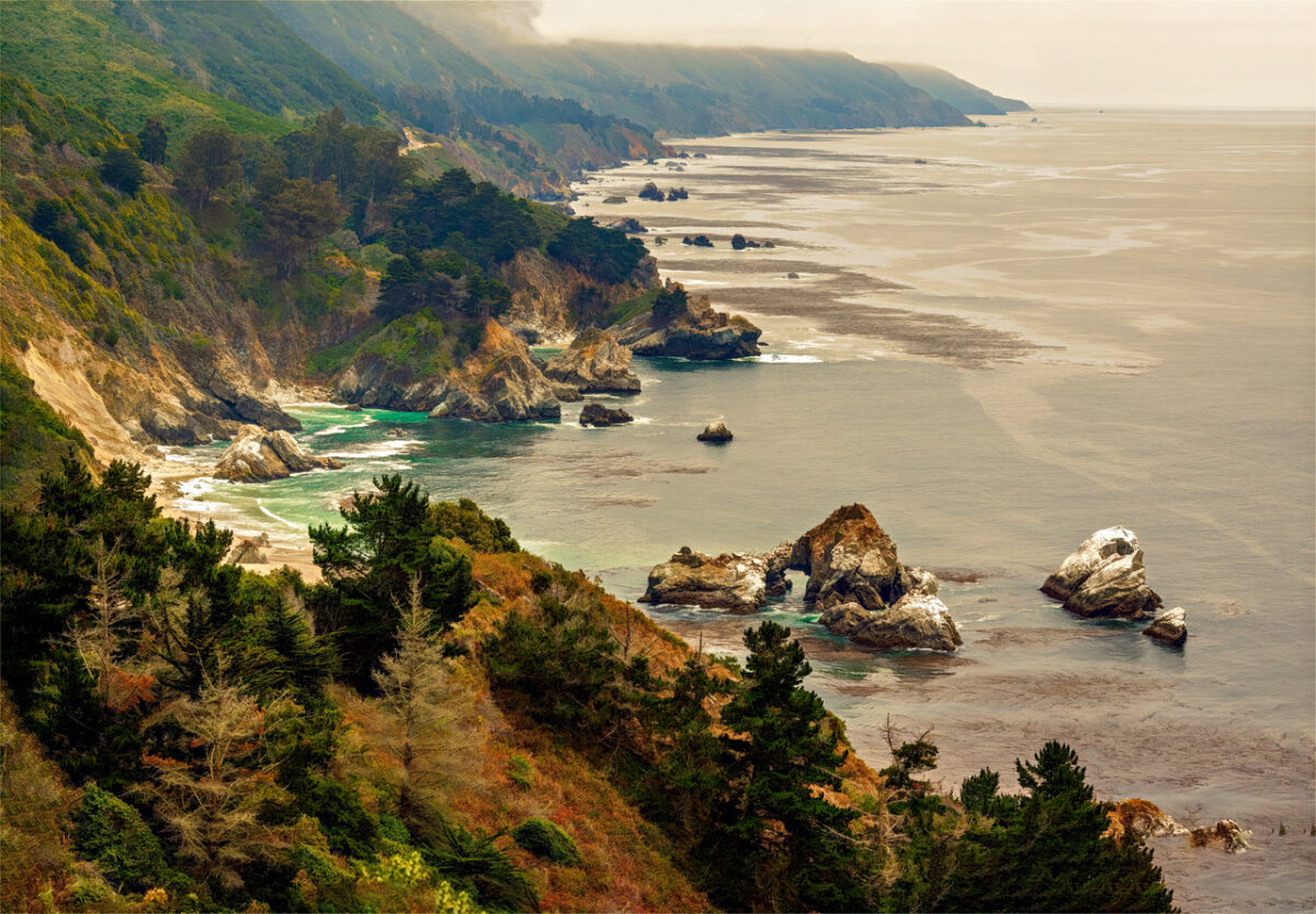
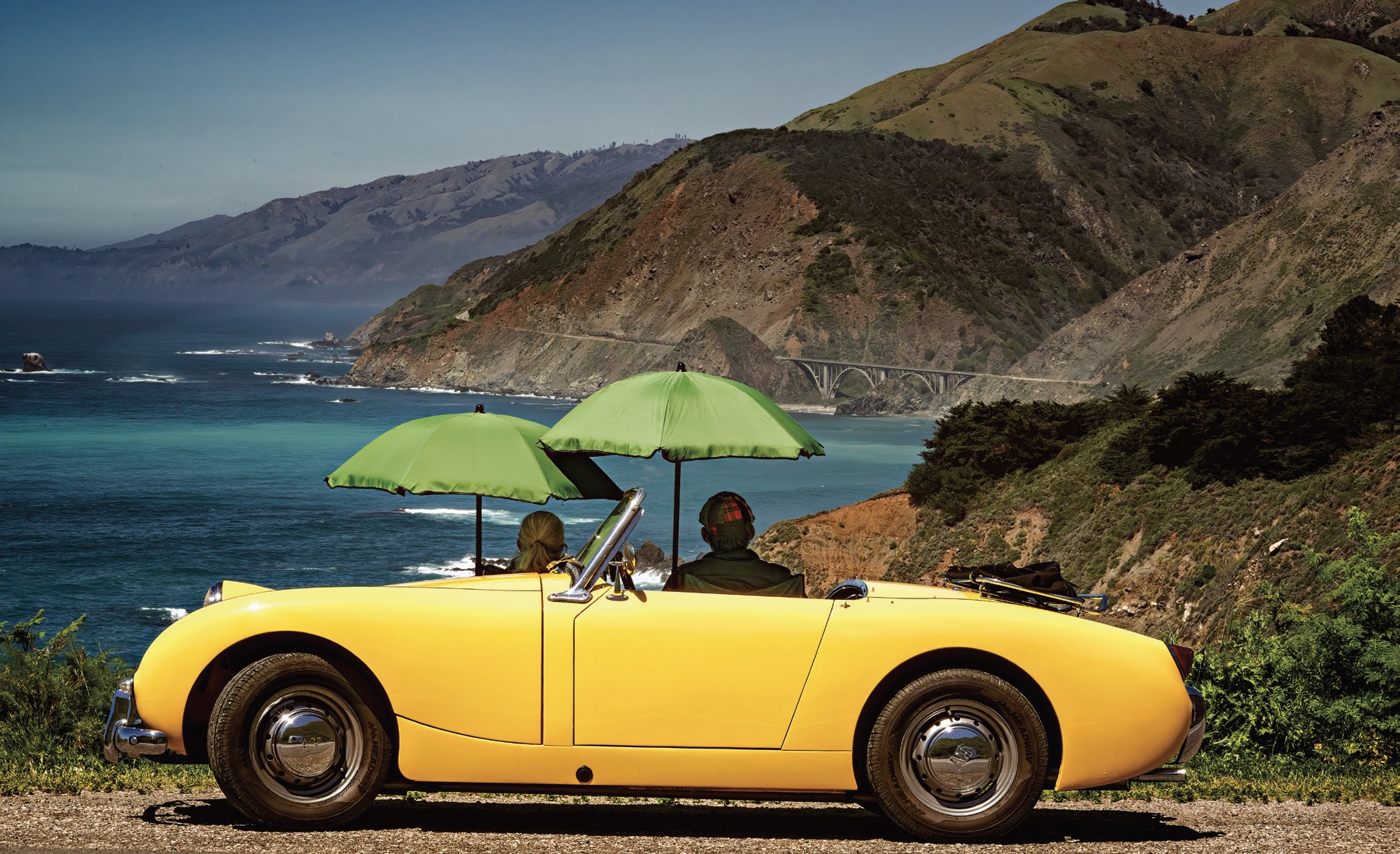
Central California’s Big Sur region of wild and rugged coast and rough and tumble mountains stretches for 90 miles from Carmel to San Simeon, intersected only by iconic Highway 1. Big Sur is about the mountains and the ocean and the interface between the two. Early-20th-century resident poet Robinson Jeffers called it the “greatest meeting of land and sea in the world.”

An artist paints amid wildflowers at Garrapata State Park. (Maria Coulson)

Grandeur and Remoteness

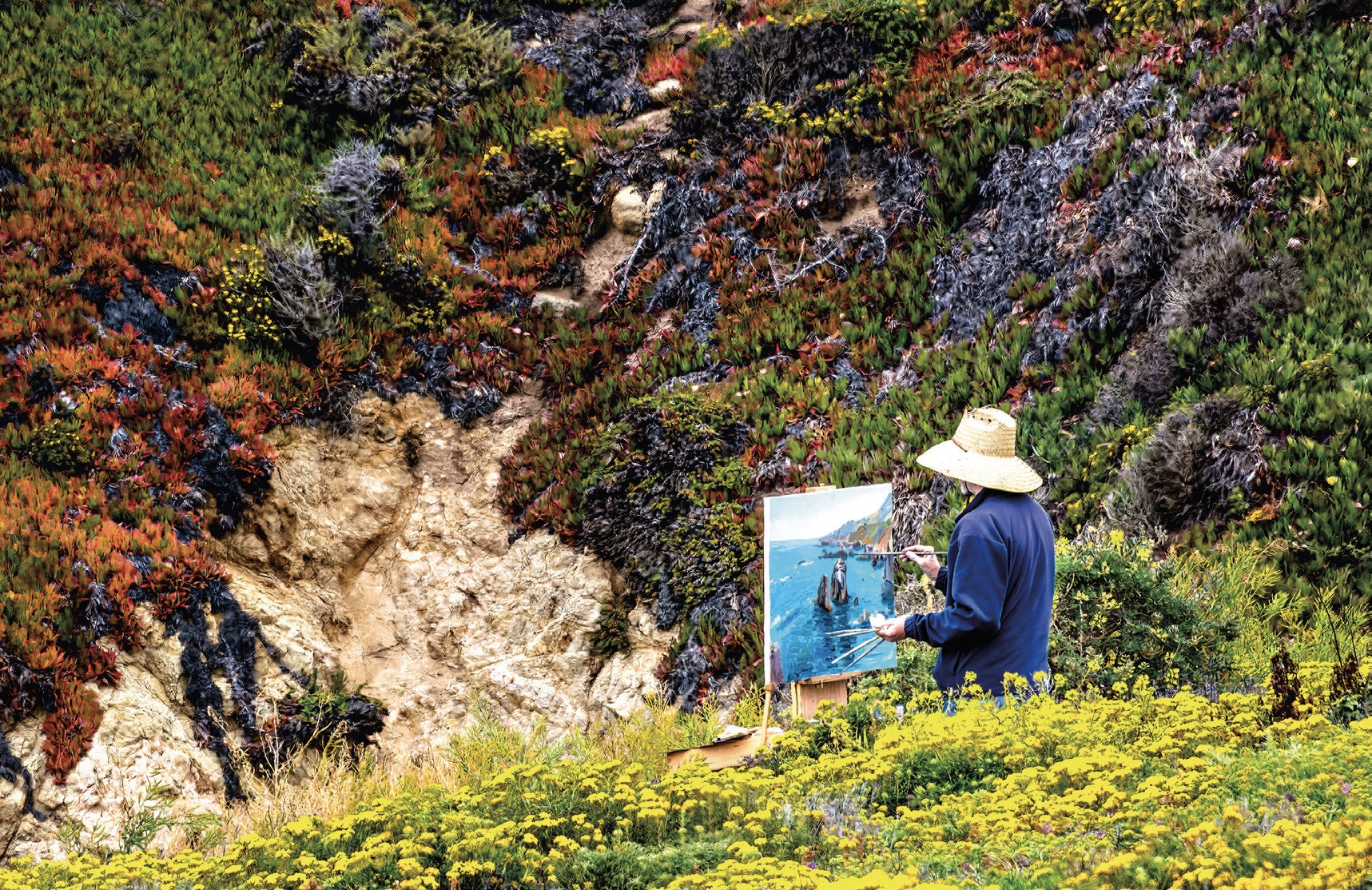
Big Sur’s grandeur and remoteness have long made it a haven for literary luminaries. Author Henry Miller developed a strong relationship with the area, embracing it as his spiritual home for 18 years.

“Big Sur has a climate all its own and a character all its own,” he wrote in his mid-century memoir “Big Sur and the Oranges of Hieronymus Bosch.” “Skies of pure azure and walls of fog moving in and out of the canyons with invisible feet, hills in winter of emerald green and in summer mountain upon mountain of pure gold. There was ever the unfathomable silence of the forest, the blazing immensity of the Pacific, days drenched with sun and nights spangled with stars.”

From his house set on a slope above Partington Canyon, Miller had imposing views of the ocean. But he chose to work in a small, wooden shed facing a wall, not to be distracted. “Big Sur is the California that men dreamed of years ago,” he wrote. “This is the Pacific that Balboa looked at from the Peak of Darien, this is the face of the earth as the Creator intended it to look.”

A clear pool ensconced between the massive boulders of Big Sur River Gorge. (Maria Coulson)

Miller fretted that the unspoiled complexion of Big Sur would be lost to the “air-conditioned nightmare” of modern life. He needn’t have worried. It is much the same now as then. Admittedly, a procession of RVs does form in the summer. But only about 1,750 residents live there.

Other than the Native American Esselen tribe, followed by a few loggers, mountain men, and pioneer families in the late 19th century, Big Sur remained a fortress for solitude. Then, in 1937, came the completion of Highway 1, with the blasting of cliff faces and the erecting of bridges spanning cavernous canyons to create a tenuous, narrow strip along the coastline.

Drama and Adventure

“This was home, this rugged, lonely coast,” novelist Nora Roberts wrote in “Daring to Dream.” “He had tooled along the spectacular Amalfi Drive in Italy, sped through the fjords of Norway, but not even their heart-stopping beauty could match the sheer drama of Big Sur.”

Its breathtaking stretch of cliff-hugging, hairpin-turned highway is considered the quintessential scenic coastal route in North America. Even if you cruise the tight track in a humdrum Hyundai instead of a snazzy Mustang convertible with the wind in your hair and the sounds of the Beach Boys’ “California Saga” celebrating Big Sur in your ears, this drive uncorks clutch-the-edge-of-your-seat excitement.

California brown pelicans are often found on rocky or vegetated offshore islands. (Maria Coulson)

You never know what’s over the next rise or around the next bend. It might be mountains that plunge into the ocean, surf and wind that pound the rocky shore and contort the cypress trees into otherworldly shapes, or a sheltered cove that harbors a tranquil sea painted in shades of turquoise and sapphire.

A Haven

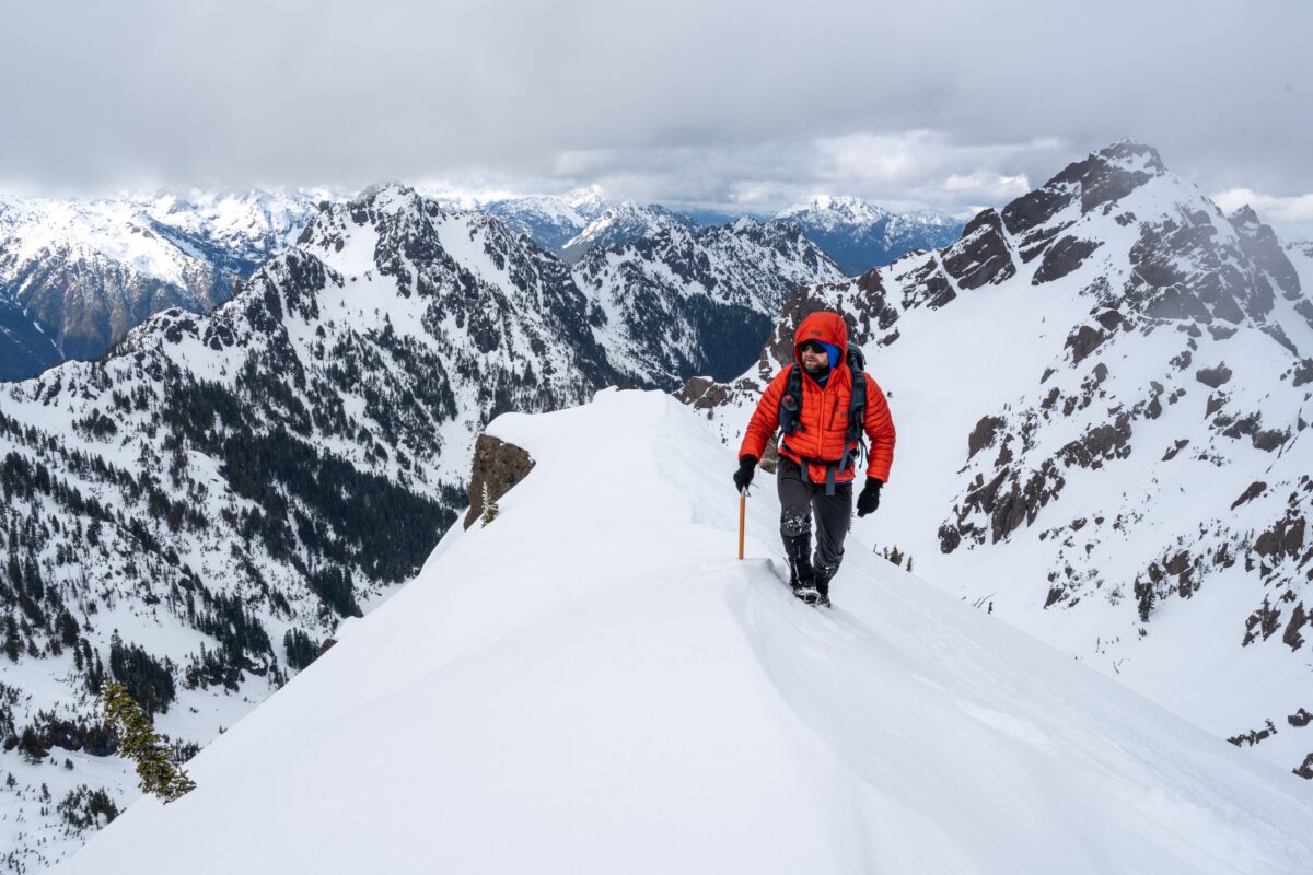
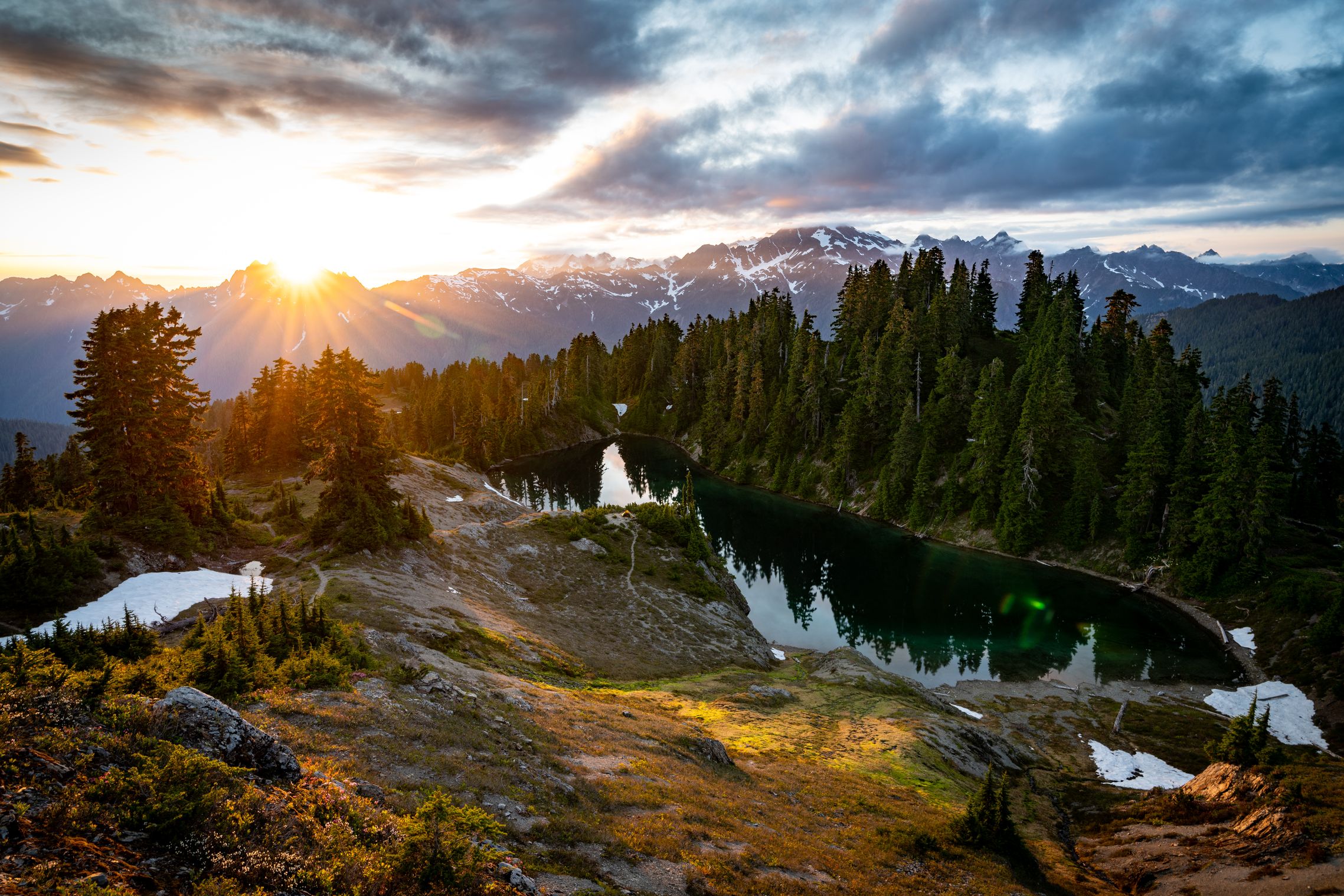
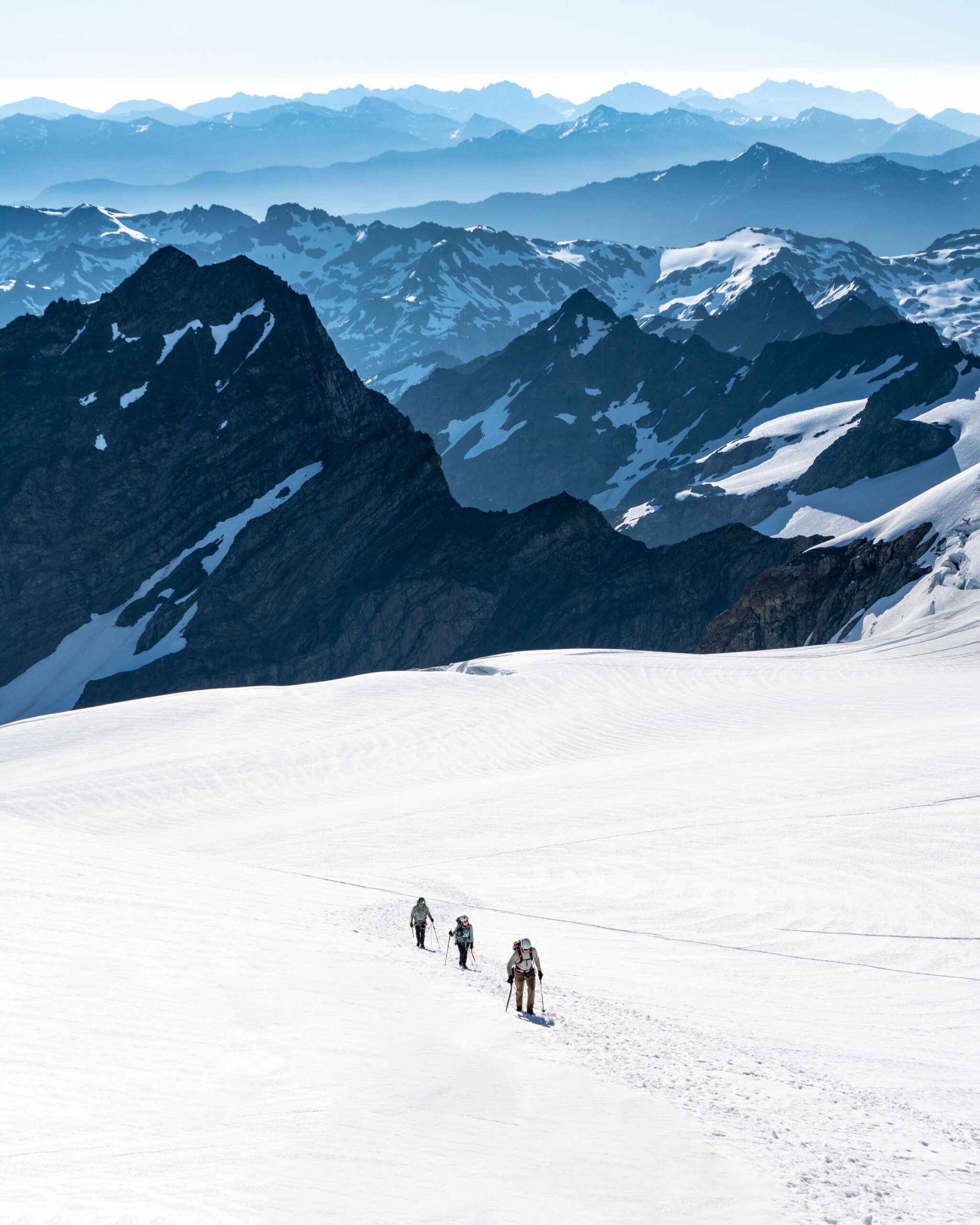
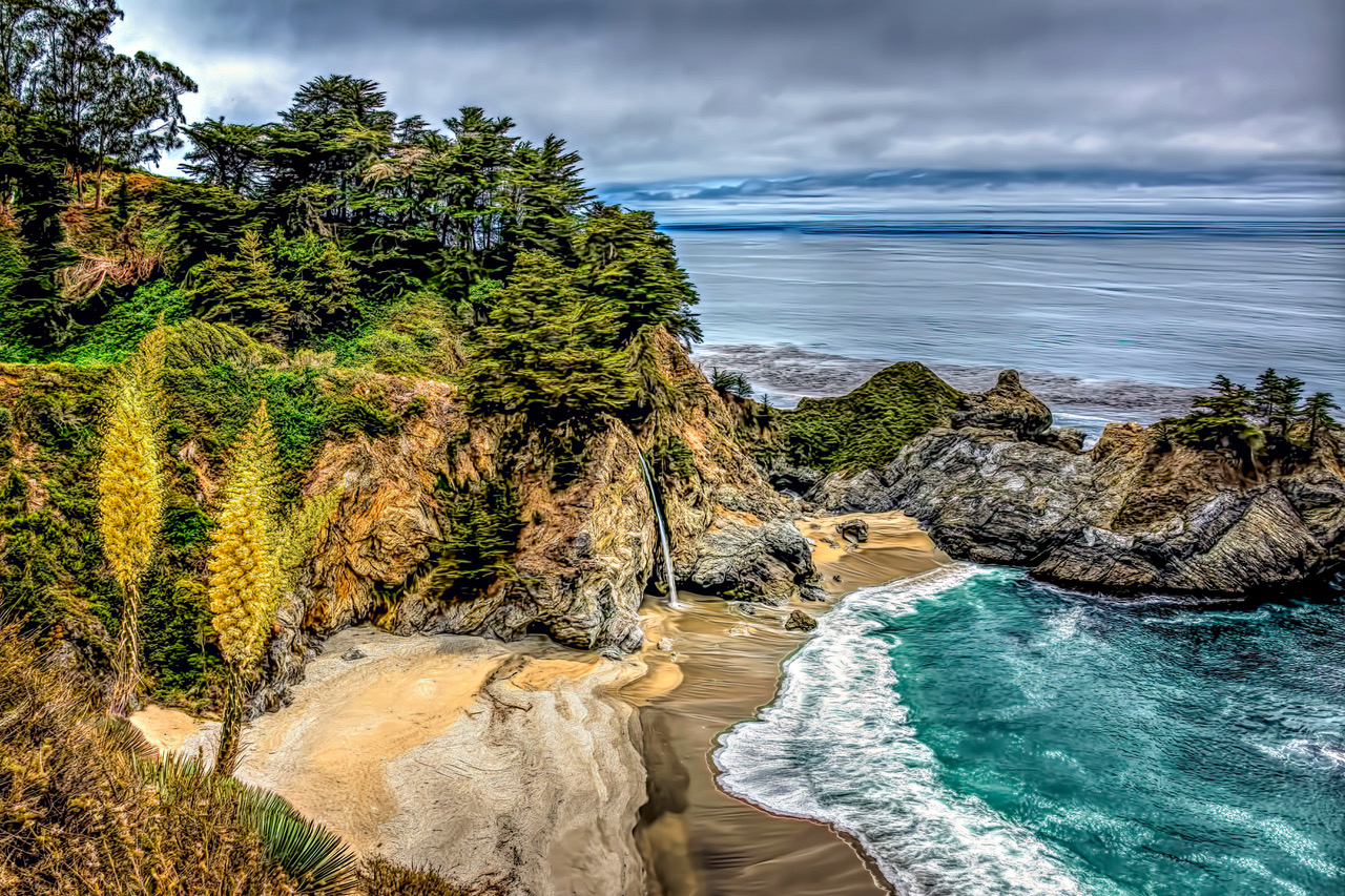
Big Sur is a hiker and naturalist’s delight with five state parks. The Ventana Wilderness of Los Padres National Forest encompasses a wide range of terrain and trails from casual to challenging and sea level to thousands of feet in elevation. Some of the shortest and easiest jaunts are among the most picturesque. Meadows and hillsides are awash with brilliant wildflowers such as lupines, goldfields, and paintbrush and Calla lilies. Old pirates’ haunt Partington Cove is where otters and seals frolic in the sea swells. McWay Falls plummets 80 feet onto a secluded beach.

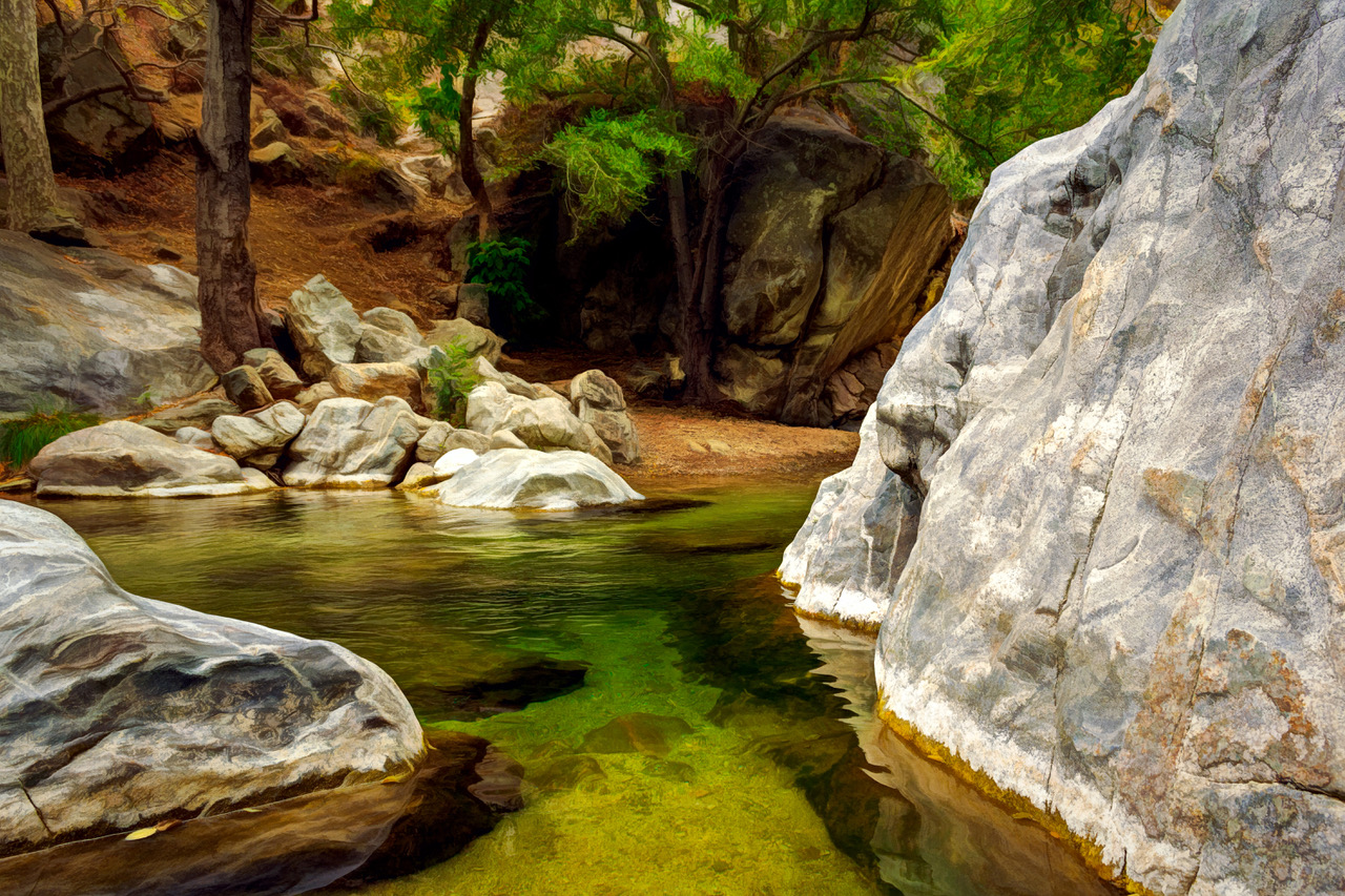
In an enchanting forest canyon stroll among a mantle of lush mosses, five-fingered ferns, and delicately flowering sorrel, the only sound is a rippling creek. You will be walking in the footsteps of John Steinbeck; let him be your guide. “Soon the canyon sides became steep and the first giant sentinel redwoods guarded the trail, great round trunks bearing foliage as green and lacy as ferns. A perfumed and purple light lay in the pale green of the underbrush … and overhead the branches of the redwoods met and cut off the sky.”

At higher altitude, the redwoods give way to choked scrub and pungent sagebrush characteristic of an ascent to 3,709-foot Pico Blanco, “a steep sea wave of marble” in Jeffers’s words. Once atop, taking in the panorama, look for California condors with a wingspan of more than nine feet, soaring in bright, cloudless sky or amid fingers of fog.

Storm clouds gather over the 80-foot-tall McWay Falls. (Maria Coulson)

Many Big Sur beaches can only be admired from afar because of high cliffs. But there are accessible strands where you can wiggle your toes in white sand. Garrapata Beach’s long shore and thunderous waves are attractive to beachcombers and lollygaggers alike. The small cove at Garrapata Creek on one end and Dowd Creek spilling over the bluff onto the beach at the other serve as bookends.

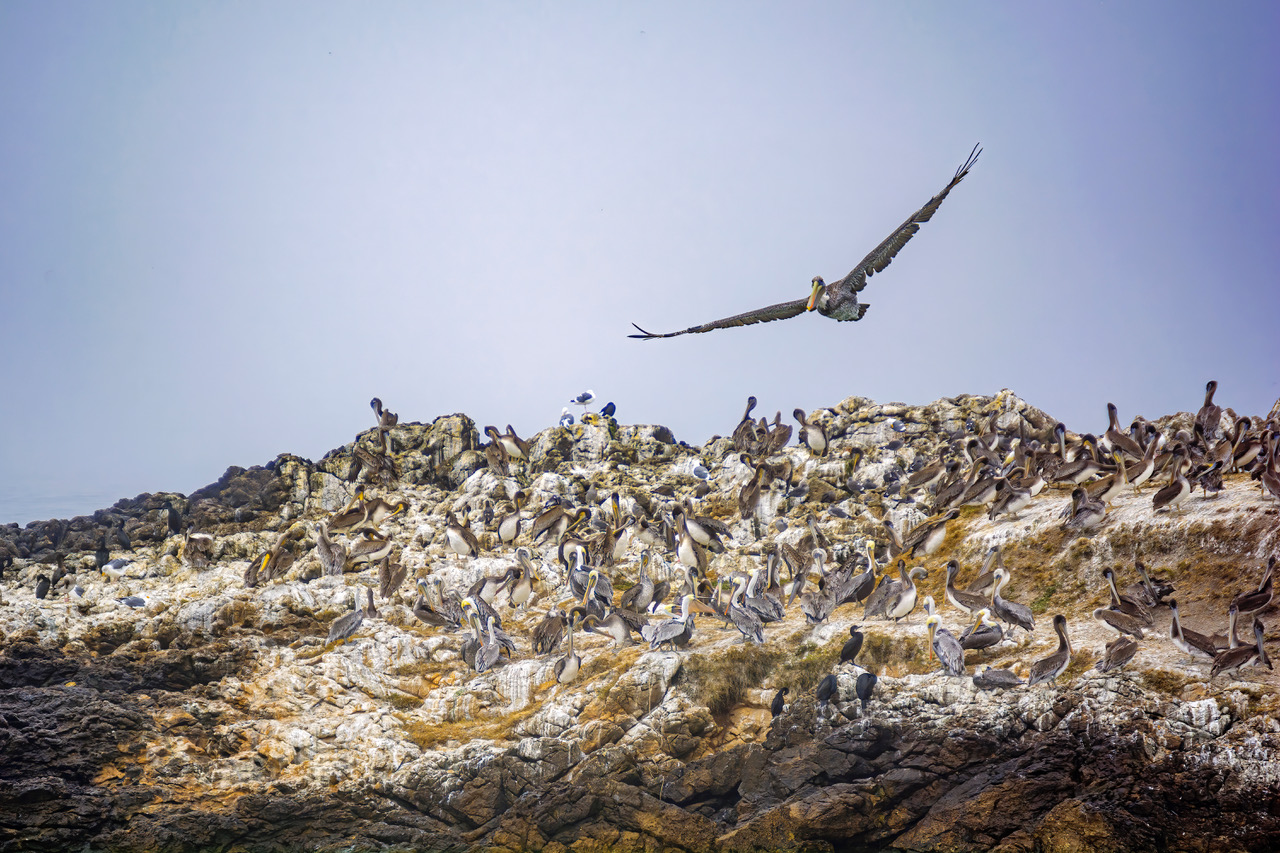
Pfeiffer Beach is renowned for its lavender-tinted sand, and offshore Keyhole Arch is popular at sunset. It’s a prime location to sight migrating gray, humpback, and blue whales. Local winged residents living along the sweeping seascape include gulls, cormorants, pelicans, and snowy plovers.

Wildlife and Wilderness

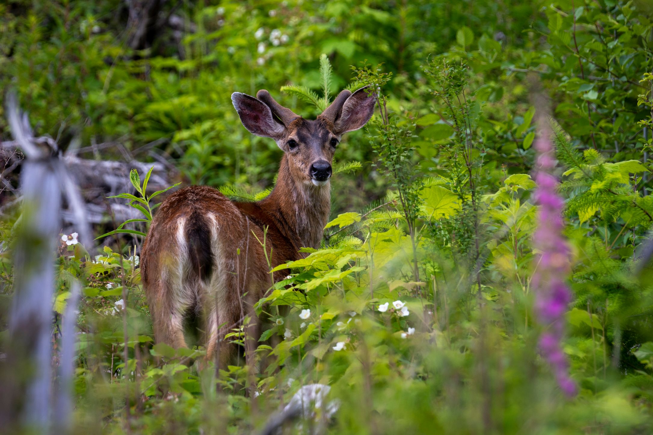
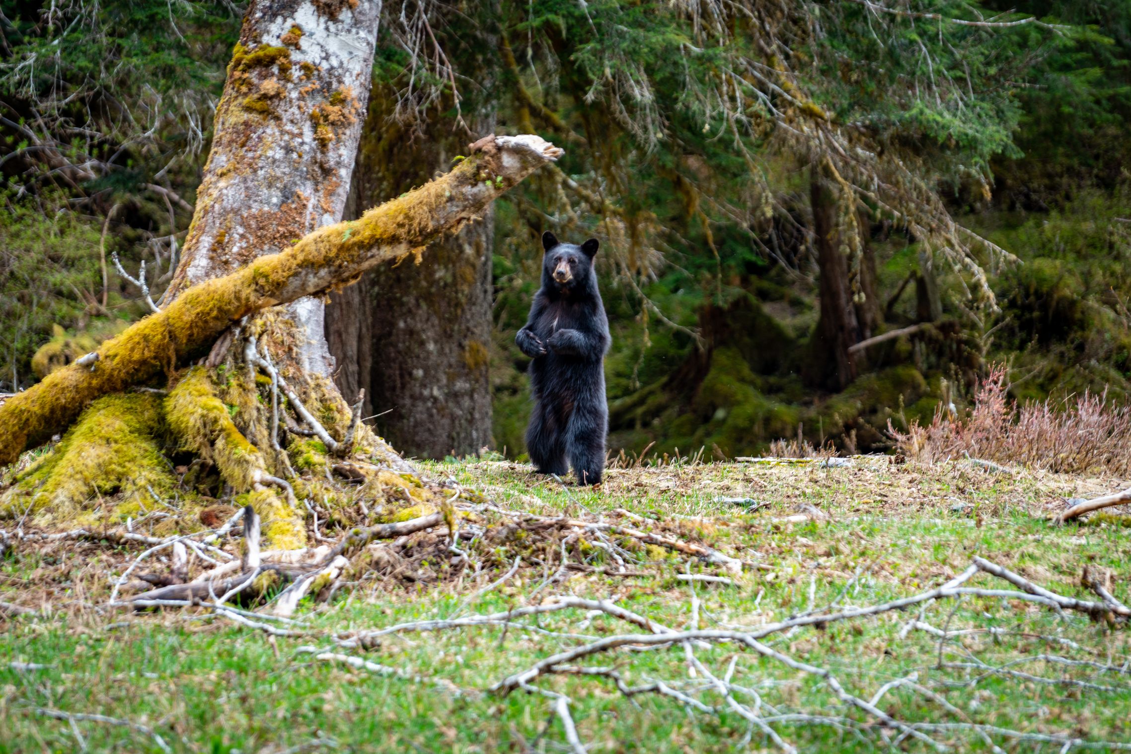
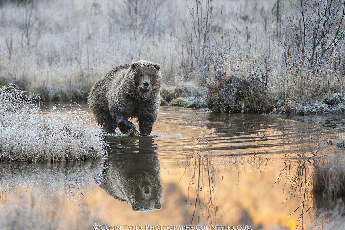
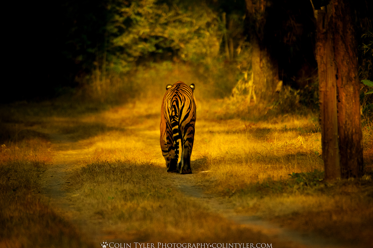
Beyond Big Sur’s scenic splendor is its ecological diversity and importance as habitat for terrestrial and marine wildlife. Nowhere else will you find fog-nurtured redwoods thriving on one slope of a canyon and sun-worshiping yuccas on the other. Similarly, sea otters and cormorants live near dry-climate canyon wrens and whiptail lizards.

Richard Brautigan wrote in his novel “A Confederate General from Big Sur”: “This morning I saw a coyote walking through the sagebrush right at the very edge of the ocean―next stop China. The coyote was acting like he was in New Mexico or Wyoming, except that there were whales passing below. That’s what this country does for you. Come down to Big Sur and let your soul have some room to get outside its marrow.”

A 1960 Austin- Healey parked along California’s Highway 1, overlooking Bixby Bridge in the distance. (Maria Coulson)

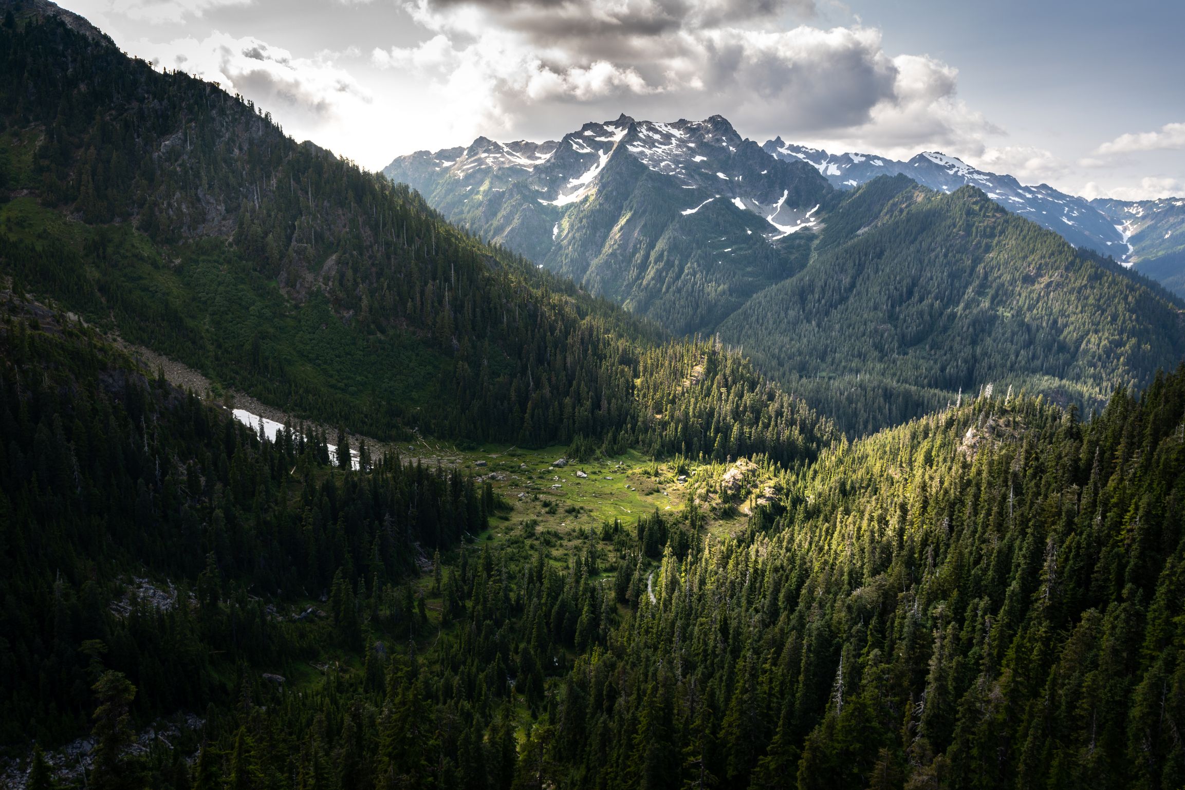
The mountainous reaches of the Ventana Wilderness that extend inland for 30 miles are a tight jigsaw of ragged ridges impenetrable other than by mule or foot. Only the most intrepid venture to the headwaters of the Big Sur and Little Sur rivers tucked away high in the Santa Lucia range. The rushing, tumbling torrents cascade down through narrow, rock-walled canyons, spilling into crystalline pools canopied by stands of old-growth redwoods.

The cool marine layer does not extend past the coastal crest, leaving much of the Ventana Wilderness hot and dry during the summer and early fall. The rare, spire-like Santa Lucia fir is found only here on the windswept slopes and rocky outcrops.

Jeffers captured this desolate and hard-bitten terrain in early stanzas of “The Beaks of Eagles”:

“An eagle’s nest on the head of an old redwood on one of the precipice-footed ridges

Above Ventana Creek, that jagged country which nothing but a falling meteor will ever plow; no horseman

Will ever ride there, no hunter cross this ridge but the winged ones, no one will steal the eggs from this fortress.

The she-eagle is old, her mate was shot long ago, she is now mated
with a son of hers.

When lightning blasted her nest she built it again on the same tree, in the splinters of the thunderbolt.”

The poem embodies the timeless spirit of Big Sur. A pilgrimage there catches time in a bottle that lasts a lifetime.

This article was originally published in American Essence magazine. 

Categories
The Great Outdoors Lifestyle National Parks Recipes

Hiking, Star-Gazing, Canoeing: Visit Buffalo National River in Arkansas for an Action-Packed Outdoor Adventure

Winding down the mountain and through the rugged landscape of dense forest scattered with enormous rock formations, the road flattens out at the tiny, outdoor town of Ponca, Arkansas. With a population of fewer than 120 people, a post office, and a couple of wilderness outfitting stores, Ponca is the middle of nature-nowhere for the Midwest. With stunningly beautiful rustic surroundings and a full array of outdoor adventure opportunities, this northern Arkansas area is perhaps one of America’s best-kept secrets.

Ponca rests on the Buffalo River, the first river in America to be designated a National River. Commencing deep in the highest elevations of the Boston Mountains, the river’s over 150 miles of winding water carve a path eastward through the wilds and wonders of northern Arkansas. Its uppermost section boasts such steep terrain, sharp ridges, crags, and crevices that roughly the first 16 miles are further designated as wild, and the upstream gem is officially known as the Buffalo National Wild and Scenic River.

Show up at the Ponca Low-Water Bridge on any spring weekend morning, and you’re likely to see groups of people wearing orange life vests, paddles in hand, shoving off from shore in canoes bearing outfitters’ logos. Across the bridge lies a short trail to a historic cabin built in 1882, as well as a trailhead leading to a scenic, full-day, 12-mile hike upstream to Boxley—a small community in times past but now a river put-in and trailhead itself. Beneath this hiking stretch, the valley extending up to the ridgetops is a favorite location for Arkansas’s only herd of wild elk. Catching sight of them grazing before a backdrop of sloping terrain near the river’s emerald green waters resembles a scene from somewhere out West.

History

The Buffalo National River was established in 1972; its founding was the result of a long, contentious battle that began in 1960 when the U.S. Army Corps of Engineers proposed the construction of two hydroelectric dams that would have destroyed the river and buried its beauties. Under the leadership of Dr. Neil Compton, area residents and outdoor enthusiasts united to fight the proposal, forming a coalition known as the Ozark Society. Their decade of unwavering commitment to the river’s preservation ultimately saved the Buffalo and the treasured wilderness surrounding it.

The Roark Bluff at dawn, one of the most stunning sites at Buffalo National River. (Tim Ernst)

The year 2022 marks the 50th anniversary of the Buffalo as a nationally protected area.

One of the few remaining free-flowing rivers left in the lower half of the country, the Buffalo River itself is a sculpted work of art, with water carving around rock and winding through untouched stretches of Arkansas wilderness. Its towering, seemingly painted bluffs are striking, and the clear emerald water that runs beneath them, vibrant and pristine. The waterway is a mecca for canoeists, kayakers, fly-fishers, and riverside campers. Perhaps an even greater set of wilderness wonders, however, exists within the surrounding crags, cliffs, and creeks beyond its banks—discoveries found after setting out with a pair of hiking boots, a map, and a backpack.

Area hiking expert Tim Ernst has spent almost a lifetime unveiling some of those discoveries, carving out trails, and documenting many of the Buffalo Wilderness Area’s wonders. His journaled publications are vital to hikers and backpackers alike, as they record miles of hiking trails ranging from the frequently traveled to the obscure, the relaxing stroll to the arduous climb, and the tiny trail to the week-long expedition.

Buffalo Wilderness Area

The nearly 95,000 acres encompassing the Buffalo National River hold a network of trails and treasures that extends even farther as it connects with the surrounding 1.2 million acres of rugged Ozark National Forest. With levels of exploration ranging from novice to hard-core hiking, and opportunities for mountain biking and equestrianism as well, the undeveloped remote areas are full of treasures waiting to be discovered by outdoor enthusiasts of all levels and ages.

Hiking the Buffalo Wilderness Area is also year-round. “You can’t hike in the Rockies, the Appalachians, or the Pacific Crest in the middle of winter,” said Ernst, “but you can hike in northern Arkansas—and the Buffalo’s emerald-colored water contrasted with scenic views of grays and browns is striking.”

Just this past January, Ernst completed an end-to-end winter bushwhacking journey starting at the river’s Cave Mountain headwaters and traveling 151 miles down to the mouth at the White River. A spinal issue prevents him from carrying a pack, so he completed the two-week excursion tentless and stoveless, sleeping under bluff overhangs and traveling ultra-light. “It was one of the most fun and spectacular trips I’ve ever taken,” he said.

Day Hiking Discoveries

You don’t need to sleep under a rock in winter to see some of the best of what the Buffalo River’s wilderness areas have to offer. Although there are plenty of single-track trails for backpackers and serious trekkers, easier trails with amazing sights and abundant waterfalls are not far from the pavement (or gravel, in this case).

The Milky Way is visible over the historic Villines Homestead in Boxley Valley within the Buffalo National River area. (Tim Ernst)

Lost Valley is one of those signature trails, with everything from vertical walls of rock reaching upward from the valley floor, to Cob Cave—named after the many cobs of corn discovered there in 1931 when it was found to be rich in preserved native artifacts. Following Clark Creek, Lost Valley’s beauty is on display throughout the entire hike, winding through a lush forest full of waterfalls, cascades, and amazing rock formations. Packed with outdoor works of art and springtime wildflowers, the short, two-mile round trip is a scenic journey from start to finish and a small taste of the entire Buffalo River area.

Another offering among the renowned trails and signature sights is Hemmed-in Hollow, a towering waterfall and impressive rock formation that spills out varied amounts of water or displays icicles, depending on the season. A more arduous trail with a 1,400-foot elevation change, it isn’t for the faint of heart. Those up for the challenge will not be disappointed, though, as the famed, 209-foot vertical rock face is the tallest waterfall between the Rockies and the Appalachians, and hiking to its base is like discovering a secret hideaway at the end of a canyon.

Nearby lies another geological wonder that, when first encountered, might feel like a sacred discovery as well. Big Bluff, accessible via the appropriately named Goat Trail, is an impressive, oversized rock face, leaning out over the river with breathtaking views. Wrapping around the mountain and morphing into a mammoth wall of sandstone, the somewhat precarious trail narrows to curve around the bluff, revealing a 550-foot drop and an expansive view of the river and backcountry below.

Backcountry and Dark Skies

Lost Valley, Hemmed-in Hollow, and Big Bluff are just a few of the amazing trails and seemingly endless sights for day hikers to explore. On the other hand, hikers preferring to gear up with backpacks and tents for a weekend or two, venturing off the beaten path in the woods, can find what they’re after on the Buffalo River Trail. Winding back and forth across the river, as well as up and down in elevation, the “BRT,” as it’s known, totals almost 80 miles in length and can take you downstream via foot rather than canoe. Eventually connecting with the almost 200-mile network of the rugged and remote Ozark Highlands Trail, the Buffalo backcountry feels endless—ideal for trekking each day and sleeping under the stars each night.

Speaking of stars, the Buffalo National River was recognized in 2019 as an International Dark Sky Park. With the darkest nighttime skies in all of Arkansas, the park is a great place to go to escape suburbia and do some stargazing, learn the constellations, or see the Milky Way. With park regulations aimed at eliminating light pollution, the natural twinkling lights of nighttime skies are now as protected as the wilderness they blanket.

Sunrise over Boxley Valley within the Buffalo National River area. (Tim Ernst)

Preservation Through Growth

Many historical cabins and preserved homesteads are scattered throughout the Buffalo area as well. Granny Henderson’s cabin, the Parker-Hickman Farmstead in nearby Erbie, and the Villines family cabins in Ponca all commemorate a past era when pioneers worked tirelessly to survive in the wilds of a rugged landscape while carving out hard livings.

Although times have greatly changed since those days, the raw, rustic, and simplistic form of much of the area is still preserved. In the past 50 years in particular, since the national park and national river were established, the town of Ponca and the Boxley River Valley have remained virtually unchanged. Nestled in the valley between mountainside and river, the old-school mountain town atmosphere is difficult to miss.

The Buffalo Outdoor Center outfitters and Lost Valley Canoe and Lodging rentals still reside as the only two businesses of tiny Ponca, and most of the cabins viewed from the road are rentals. There are no motels. Although certainly adding to the area’s charm, the simplicity also poses some issues during crowded times, especially as the area grows in popularity.

“Elk, waterfalls, and hiking trails have increased traffic to the Buffalo River immensely,” said Ernst. “Particularly when the big bulls are out there bugling.”

The once-unknown, tiny area’s increased popularity hints at the need for new infrastructure to handle it—apparently, grants are in place to do just that. In the meantime, though, this area is still “in its infancy,” as Ernst said, citing that there aren’t too many places left in the United States where you can still chart new territory as a hiker or backpack a 47-mile section of backcountry without any established campsites.

Labeled the “Natural State” for a reason, Arkansas has plenty of raw, rare, hidden beauty, and although it’s rapidly growing, the Buffalo River remains a somewhat unrecognized outdoor mecca. “I doubt that the personal experience of discovery will ever be completed here,” Ernst challenged. So next time you’re in search of adventure, find Arkansas Highway 43 on a map, head south, and wind down into Newton County, stopping off in Ponca. A bit like venturing off the grid, the disconnection from your everyday world may end up connecting you with exactly what you’ve been looking for.

This article was originally published in American Essence magazine.

Categories
Features National Parks The Great Outdoors

Scaling the Olympic Peaks

Nate Brown’s deep appreciation for the Pacific Northwest stems from a four-day road trip across the Olympic Peninsula in 2013, during which he surveyed snow-capped mountains and lush forests nestled between the coastlines. An Army mission had brought Brown there, and he was captivated by the landscape that stood before him. After retiring from the Army in 2018, he made it his mission to fully explore the Olympic Mountains by climbing 30 summits within a period of just three years. In September 2021, after hiking over 500 miles and climbing an astonishing 160,000 feet, he achieved just that.

A high alpine lake, aptly named Lake Beauty, in the Olympic mountains. (Courtesy of Nate Brown)

While serving in the Army, Brown had set foot in almost every corner of the United States but had not traversed the Pacific Northwest. So after a break from active duty, he decided to re-enlist under the condition that he be placed in Washington. Stationed at Joint Base Lewis-McChord, southwest of Tacoma, Washington, Brown was blown away by the natural beauty of the mountainous terrain. When his mission ended in March 2018, he was ordered to leave his base and serve at a different location—but he politely declined. After 13 years of service, Brown deemed it time to spend the rest of his life in the picturesque Pacific Northwest. Since then, Brown has adopted Washington as his chosen home with no plans to ever leave.

A Passion for Mountaineering

Veterans from Veterans Expeditions climbing to the summit of Mount Hood, the tallest peak in Oregon. (Courtesy of Nate Brown)

While in the Army in 2015, Brown was trained in technical alpine climbing by The Mountaineers—a nonprofit community on a mission to share knowledge and encourage others to partake in outdoor activities such as alpine climbing, mountaineering, wilderness navigation, sea kayaking, and snowshoeing. Brown’s class lasted for about six months and took place in the evenings at the community center. Students learned technical alpine climbing theory before going down to Mount Rainier for a few weekends a month to put their knowledge to the test.

The most important thing Brown learned was that in order to improve in technical alpine climbing, he needed to find a core group of climbing partners whom he trusted. An individual’s fitness level is important to take into consideration. According to Brown, finding someone with approximately the same fitness level is best, so nobody struggles to keep up during a climb. Another key factor is having good judgment: many people encounter “summit fever” and become adamant about reaching the top regardless of conditions. That mentality presents many hazards, not just for the individual but for the entire group. Lastly, remaining humble is key. As Brown explained, “no matter how much you know and how good you are when you are in a contest between you and the mountains, the mountains will always win.”

A group of veterans from Veterans Expeditions on the summit of Mount Saint Helens in a winter storm. (Courtesy of Nate Brown)

While still on active duty, he discovered Veterans Expeditions, a Colorado-based organization that encourages veterans to explore the outdoors. “They [the group] would come to the Pacific Northwest every now and then and climb mountains, like Mount Rainier and Mount Hood,” he said. One day, Brown reached out and offered to accompany them as a photographer on their trips, taking pictures of veterans that they could keep or give to sponsors. So Brown connected with the group and started climbing peaks with them—as “the guy in the background with the camera,” he laughed.

After a year or two, Brown was asked whether he would be interested in leading some trips of his own, as he was more experienced in mountain climbing. So in 2020, Brown led a three-part volcano climb series involving beginner-friendly treks to Mount St. Helens, Mount Adams, and Mount Hood. He and two other experienced mountaineers assumed leadership of groups of eight veterans each. The entire expedition lasted a few months, and the leaders taught veterans important skills like how to use ice axes and wear crampons (metal traction devices that attach to shoes, improving snow mobility).

The Olympic Mountain Project

A sunlight forest valley in the backcountry of the Olympic mountains. (Courtesy of Nate Brown)

In May 2019, Brown decided to embark on a new endeavor. A friend asked him what his favorite place in Washington was, and Brown instantly replied the Olympic Mountains. But as they sat down and peered at a giant folding map of Washington, Brown observed that though he claimed it as his favorite place, he hadn’t ever fully explored the Olympic Peninsula. “I realized I had really only been on the outside edges—because the Olympic Mountains are a circular cluster,” he explained. “I should climb enough mountains spread out throughout the entire Olympic complex to say without a shadow of a doubt, I have seen the Olympics.” He immediately started planning his project. He set out to explore 30 mountains, not only from the outer edges but also from the hard-to-reach interior areas.

Through the expedition, Brown, who has a full-time job working for a federal government agency, also hoped to raise awareness of the issues facing the Olympics, including underfunding and climate change, by partnering with Washington’s National Park Fund (the official philanthropic partner of the three major Washington National Parks including Olympic National Park) and donating 25 percent of the profits from selling his photo prints to the organization. He wanted to use those funds to support the organization in keeping the parks open for all to enjoy.

A deer in the Olympic forest. (Courtesy of Nate Brown)

Planning such an extensive project was no easy feat; Brown admitted that he spent more time researching than actually climbing the mountains—as the inner mountain peaks were relatively uncharted. Of the 30 peaks he would climb, only four of them had trails leading to the top. Brown had to research the rest and plan for unexpected obstacles as much as possible, hoping to ensure safe paths through the wilderness. After many hours and days poring over various maps of the Olympics, he finally mastered the layout of the mountains. “I don’t even have to reference a map anymore. I have it memorized,” said Brown.

Cruising Through Rocky Paths

In 2020, Brown was hit with an unforeseen predicament: the pandemic. National parks faced extended closures from April to July, due to measures set forth by the Washington governor. According to Brown, those months are considered prime climbing season; as some of the snow has melted, travel is easier and the risk of avalanches is low. During that time, he also had difficulty convincing climbing partners to join him on his trips, which sometimes required hiking 60 miles just to climb one peak. As a result, he went on several trips by himself. Brown’s drive to achieve his goal of exploring the Olympics was the fundamental factor that led him to continue his great expedition. “This is my favorite place in the entire world, and I’m going to see the whole thing. I just needed to see it through,” he said.

Mountain climbers often travel in groups for safety. On his trek up Mount Olympus, Brown was accompanied by six of his friends, and together they formed glacier rope teams. A six-person team is the standard for safe glacier travel, Brown explained. “If you had two ropes, each rope would have three people on it—then you can get yourself out of any tough situation,” said Brown.

A black bear in the Olympic forest. (Courtesy of Nate Brown)

His mountaineering project lasted for nearly three years, during which time Brown encountered much wildlife, including black bears, elk, and marmots. “I encountered so many bears that I would come to be completely numb to them,” he laughed. He explained that there are mostly black bears in the Olympics, which are often less aggressive than grizzly bears. He also photographed pikas in the Cascade Mountains. Brown said that he even spotted paw prints belonging to mountain lions, though he never saw one in the flesh.

When he’s not climbing mountains, Brown is often seen, camera in hand, capturing the beautiful landscapes of the Pacific Northwest. He admits that on any given trip, he shoots a minimum of 300 photos. On longer trips, it’s not unusual for him to return with upwards of 1,000 photos. The pandemic has allowed Brown ample time to revisit images and reflect on the memories and places he captured. Through this, he discovered photos he had previously overlooked. 

The 30 Peaks

The path to success is seldom smooth, and Brown learned that there are many unforeseen obstacles even after extensive planning. Bodies of water are typically represented on maps by squiggly blue lines, but one never truly knows whether those might represent a creek, a two-foot water ditch, or a raging river, Brown admitted. The seasons also play a big part in the depth and intensity of water features, with spring bringing increased water flow compared to fall when water tends to evaporate more quickly. “There were several times where I got to a point where I had to cross this body of water and there was no safe way to do it,” said Brown. He would have to turn around and reevaluate his plan, or completely remove a peak from his list and replace it with another one. “That was a benefit of choosing my own peaks—I got to move the pieces around as I thought fit,” he said.

Upon visiting certain peaks in the summer and revisiting them in the colder months, Brown noticed striking differences in appearance and captured them through photos. A mountain slope usually covered in bushes, shrubs, and small trees would appear entirely flat in winter, buried under a thick blanket of snow. The few trees that remained uncovered would take on different shapes, blown by icy gusts and frozen in place. 

Trekking across the snow. (Courtesy of Nate Brown)

Brown carefully handpicked the 30 peaks, making sure they spanned the entirety of the Olympics, but he had to consider many factors to make the expedition achievable. He said that the Olympic Mountains are known for having brittle, crumbly rock composed of ancient seafloor, so the danger of rockfall is always imminent, especially during vertical climbs. Whenever possible, Brown and company would climb side-by-side, so no one would be in front of another. The few times when this wasn’t an option, whoever was behind would hide in a cubby, or hole, while the person in front climbed up, stopped, and gave the all-clear. Communication was very important in those instances; otherwise, said Brown, one might send rocks flying down onto the person below.

A glacier-fed alpine lake in the Olympic backcountry, with McCartney Peak behind it. (Courtesy of Nate Brown)

In early September 2021, Brown concluded his expedition by climbing Mount Steel. As he stood at the summit over 6,000 feet above, the sun rose from behind the distant mountains and thick clouds swirled down below. “I stood eye to eye with each of the peaks I had climbed previously. It felt as though they were all standing in silent unison, giving me this one last moment to forget about everything below. One last morning where for a moment, nothing else existed; just me and the Olympic Mountains I have spent so much time in,” Brown wrote in a Facebook post. He scanned the horizon, naming and thanking each peak for seeing him safely up and down its jagged slopes. After climbing over 160,000 feet and traversing 500 miles, Brown had safely and proudly made it to the finish line. He felt relief and gratitude. Although the adventure ended, Brown would never forget his time in the Olympic Mountains, and the photos he captured during his journey would remain a testament to his accomplishments.

Categories
Features National Parks The Great Outdoors

From Ashes to Beauty

Nature has always been at the forefront of photographer Colin Tyler Bogucki’s life. Growing up, he and his family lived in Outing—a small town in “Lake Country” in Northern Minnesota. Surrounded by woodland and lakes, he felt it was the perfect place to grow up. “I was outside all the time and always connected to nature,” he said. Swimming, fishing, and hunting were a few of his passions. In 1991, Tyler attended college, studying psychology. After completing his coursework in 1995, he traveled to Alaska for an internship at a counseling center, where he immediately fell in love with the untamed wilderness.

Journey to Alaska

December Sunrise, Eagle River Nature Center, Alaska. (Colin Tyler Bogucki)

Equipped with a Minolta point-and-shoot film camera, he drove all the way to “the last frontier” in his little Toyota pickup truck. Tyler considers that trip as the greatest journey of his life. Struck by the natural beauty and scenery, he was hit with newfound inspiration. Words flew from his pen onto paper, taking the form of elaborate poems. “And I just had to keep pulling over and writing all these lines that were coming to me as I was driving,” he said. Tyler would go on to spend many days capturing the many wonders of wildlife through pictures and poems. “I didn’t want it to end. I didn’t want to arrive in Anchorage—I just wanted to keep journeying because it was so inspiring,” he said.

After finishing his internship, Tyler decided to stay as a substance abuse assessment counselor. However, he was far from happy. “It just wasn’t for me,” he said. Outside of work, he would take every opportunity to practice his photography skills. It was not until a few grueling years that he decided to take the plunge and leave his job to work on his art. In 1996, after being gifted his first professional camera for Christmas—a Nikon SLR film camera—Tyler had one of his photos published in the Anchorage Daily News. Even when offered a lucrative career opportunity with the federal probation system in Alaska, Tyler instead chose to follow his heart. “I knew I was walking away from financial stability,” he admitted. “But I could not bring myself to do that work.”

Struggles and Setbacks

Tyler spent the next few years in Minnesota, juggling between bartending and manual labor jobs while honing his photography skills. Finally, in 2007, Tyler moved back to Alaska and found work in a small portrait studio where he learned portrait photography and studio lighting. “I ran that for about five or six years in the little town of Eagle River, which is where I live now,” he said. While Tyler enjoyed the skills and techniques he learned while working at the portrait studio, he primarily sees himself as “a nature and wildlife guy.” After leaving the studio in 2013, he was once again at a crossroads, battling for financial stability. He fought off many moments of regret for not going on to graduate school or seeking what he called a “professional career.” Despite many things seeming hopeless, Tyler was very grateful to be renting a small cabin on two acres of land in the woods of Alaska, located on the end of a road, with a creek running in the back of it. Tyler and his cat, Spike, lived a life that many would only dream of. In the summer, wildflowers and strawberries would grow all around the house. “There was also a deck out back where I could play my guitar and listen to the creek,” he said.

Tyler playing guitar in Akaroa, New Zealand. (Joshua Dean West)

April 22, 2013—Earth Day—Tyler was awoken to smoke alarms screaming. The cabin was on fire. “And I did everything I could. I had a couple of fire extinguishers and I started in the front,” he told me. “I emptied the extinguishers, I threw snow at it from outside. I couldn’t control it.” At some point, Tyler ran out of the back door but then attempted to go back in for his cat, who had gotten into the basement; however, a blast of smoke and heat nearly knocked him over. This was the point when it dawned on him that he would probably not be able to rescue his beloved friend. “I stood there and yelled and yelled for him,” he said, his voice breaking.

He spent the next few hours in his neighbor’s house, who had called the fire department after waking up early and witnessing the horrific event. Tyler explained that where he was living, there were no official firefighters—only volunteers. “So it was more than an hour before they were there spraying; then a tree came down, power lines came down and blocked their path so they couldn’t get near it because of the live power lines,” he said. As the fire got bigger and bigger, Tyler’s hopes became smaller. “I was at my neighbor’s, watching, thinking okay, they get here soon, maybe the house can be salvaged. Okay, maybe not. Maybe my cat can be saved, maybe not.” By the time the firefighters were done battling the fire and smoke, the cabin had been reduced to rubble. Spike had also passed away due to smoke inhalation. This event left Tyler pondering the reasons for such a catastrophe during a time when he was already experiencing so many setbacks. Today, he realizes that he had to go through this to discover his life’s true purpose.

Double rainbow, Eagle River Valley, Alaska. (Colin Tyler Bogucki)

Rising From the Ashes

Tyler always expressed a deep desire to travel and explore the world. He was often approached by friends asking him to accompany them on their photography travels. He would always decline. In 2012—the year before the house fire—a good friend of his from Montana invited him to explore India with him for two months. “I said, man, I’d love to join you but I can’t. I have this house, I have a cat—I can’t leave for two months,” he explained. A year later, after the house fire, Tyler was reminded of his friend’s offer and realized there was no longer anything stopping him. He had kept important documents in a file cabinet, but most of the contents in it had been destroyed in the fire—except for his passport. Firefighters found the document on top of the snow, completely intact. “I didn’t realize how significant of a sign that was until a few weeks later. I called my friend and said, well, you know, if the invite is still open, I want to join you. I want to go to Asia and India with you.”

A Bengal tiger on the trail of a tigress in Bandhavgarh National Park, India. (Colin Tyler Bogucki)

The pair traveled to Thailand and Cambodia before spending a whole month in India photographing tigers in various national parks. Tyler considers his trip to India as an inspiring, transformational journey that allowed him a means to express himself through his photography like never before. In India, they visited four parks and only managed to spot a tiger in their third park. During this time, he found that many people on social media waited eagerly for new updates on his journey. “People were following my story with anticipation. They would learn on Facebook every day and see what happened next,” he said.

The day they had their first encounter with a tiger, Tyler said that he could almost feel it nearby. “It was like I was hunting again, waiting for something. I just had this feeling in my gut that my cat was there with me and that today was the day.” When attempting to locate tigers, one should try to listen out for any warning calls from other animals. Sure enough, the call from a nearby deer confirmed his instincts. “We drove up the road, and there was this giant male Bengal tiger right in front of the jeep,” he said. The pair of friends were ecstatic by their discovery after all their effort. By the time Tyler sat back down in the jeep, he was trembling, and his eyes were watering. “We went all this way for this reason,” he said. Tyler had brought some of his cat’s ashes to India in a little container that he carried with him inside his camera bag. The day after spotting his first tiger, he returned and left his companion’s remains in a watering hole close to where he had spotted the tiger. That same day, either through fate or a stroke of luck, he had a rare encounter with another big cat, this time a leopard.

Spotted leopard in Bandhavgarh National Park, India. (Colin Tyler Bogucki)

Before the fire, Tyler admitted that he never would have thought about traveling around the world, but “life changes really quickly.” After his trip around Asia, he spent a brief amount of time back home in Minnesota before embarking on yet another extended trip to New Zealand. There, he took part in a program designed to connect willing workers with organic farms around the country, in exchange for food and lodging. “Sometimes it’s just a home with very elaborate gardens and landscaping. Others are actual farms or wineries,” said Tyler. He noted that it was a great way to meet locals and other travelers and that none of this would have been possible if it hadn’t been for the fire.

From Hunter to Photographer

After a summer in Valdez, Tyler decided to move to Eagle River Nature Center in Alaska—close to where he had been living before—in October 2014, as a resident volunteer. He has since been living there as a resident staff member and has acquired the position of Assistant Manager. His backyard now consists of the beautiful Chugach State Park with its abundance of wildlife.

Living in Alaska and observing the wondrous wildlife caused Tyler to view animals through a different lens. Hunting with family used to be one of his favorite pastimes; however, through photographing animals, Tyler developed a new admiration for them, and a softer, more compassionate side of him was awoken. Having the opportunity to express himself through various creative outlets played a great role in this transformation. “I had an English composition writing instructor who really inspired me with poetry. And that was in high school. He had a profound influence on me,” he said. Years later, Tyler sent him copies of his poetry, and the pair stayed in touch for a brief period. After the fire, he was pleased to discover that his little book of poems, which he had worked on during his first drive up to Alaska, had remained intact. “I thought they were gone forever,” he said. “I was just so overwhelmed that I was in tears.”

Some of his first wildlife photographs took place in the late ‘90s in the vast natural plains of Alaska, particularly in Denali National Park. He was just starting to learn about composition and lighting—which were all new to him. A significant turning point for Tyler was when he traveled to Katmai National Park and Preserve in 1999 to photograph bears. “I just had a wonderful time because there was beautiful scenery and just bears all around,” he said. He loved photographing those bears and felt very connected to them. “I just gained a great appreciation and respect for them.” To this day, Tyler considers this experience pivotal in helping him establish his passion for wildlife photography. 

Alaskan brown bear looking for salmon in autumn. Eagle River Nature Center/Chugach State Park, Alaska. (Colin Tyler Bogucki)

Photographing wildlife helped Tyler experience a greater connection to nature than ever before. Through collecting pictures, rather than trophies, he began to appreciate nature for what it truly was. By appreciating smaller aspects of the scenery, smaller animals, and even insects, he has developed a keen interest in animal behavior, and his relationship with wildlife has only increased. “I’ve learned to read their body language, and just developed such a different appreciation for the natural world because it’s no longer just a target.” Now, he simply wishes to capture these brief magical encounters with wildlife through his photos, and share them with the rest of the world. What initially started as a hobby has blossomed into a full-time career, a passion, and a goal. “People appreciate what I do and what I share as it brings them joy, inspiration, and a sense of serenity,” he added. For this reason, exploring, creating, and sharing his photography with the world has become a central focus of Tyler’s life; it is in these moments when he truly feels he is accomplishing what he was born to do.

Male Bengal tiger in Bandhavgarh National Park, India. Recognized by National Geographic editors and placed in the Top 10 out of nearly 12,000 images. (Colin Tyler Bogucki)

Tyler’s work has often been recognized in National Geographic, where he won numerous photography competitions over the years. His image of a male Bengal tiger was selected as one of the winning images in National Geographic’s “My Shot” photo contest, out of a total of 12,000 entries. His Northern Lights photography also captured the attention of the United States Postal Service and was featured in one of their commemorative stamp sheets as part of a collaborative arctic climate research project.

Sharing the Magic of Wildlife

With the successful sales of his photography prints, Tyler managed to travel again. He visited Australia for a few weeks, and then Cuba, where he provided photography tours to keen wildlife enthusiasts. This new endeavor brought Tyler newfound joy and inspiration. Traveling to different parts of the world and photographing wildlife had become his passion, so he and a photographer friend decided on creating Nat Expo Tours. According to their website, their mission is to share the amazing natural wonders of the planet while offering photo tips and techniques to touring participants. Future tours are planned to take place in three exotic locations: Iceland, Cuba, and Namibia.

The tours allowed Tyler to look inward and share his knowledge and appreciation of photography with others. “Seeing them grasp the concepts and start to understand things is a great feeling,” he said. Tyler believes the best feeling for him is when people attend the tours and come away with something that they wouldn’t have otherwise captured. “It’s just wonderful.”

Tyler photographing the Fagradalsfjall Volcano in Iceland. (Courtesy of Colin Tyler Bogucki)

Tyler enjoys exploring different creative media to express his art, with videography being his newest venture. In late 2021, he released a mini-documentary featuring the active Fagradalsfjall Volcano near Reykjavik, Iceland, during one of his photo tours. Tyler looks forward to incorporating this new form of storytelling into his art.

Tyler and his cat, Spike, in front of their cabin in 2007. (Michael Gandolfo)

Constantly on the move, traveling from one location to the next and photographing stunning wildlife while meeting people from all cultures and backgrounds, Tyler has established lasting connections with the world around him. Pursuing a career in wildlife photography has led to each day being different from the last.

Through loss and grief, he has discovered adventure. His travels have taught him more about himself and led him into discovering his true purpose in life, and while he often misses his furry companion, he believes that he was liberated from a life of fear and uncertainty to one full of excitement and creativity. “As long as I’m exploring, creating, and sharing, then I feel like I’m where I need to be,” he said. Today, he proudly displays a tattoo of Spike’s paw print on his right shoulder—a tribute to their everlasting friendship.


Categories
National Parks The Great Outdoors

Niagara Falls: America’s First State Park

On the American side, Niagara Falls brings in about 9 million visitors each year, according to Western New York Connect. With more than 13 million visitors on the Canadian side, the combined total is roughly 22 million yearly visitors. The park offers a great deal: one-of-a-kind scenery, live entertainment, walking and hiking paths, boat tours, and more.

The area around Niagara Falls has a rich history, from the beginning of America to the industrial revolution. The Erie Canal, the first canal in the United States to be constructed with public financing, runs nearby, connecting the Great Lakes to the Atlantic Ocean. Niagara Falls was the site where Nikola Tesla and Westinghouse Corporation in 1895 built and installed the first-ever alternating current hydroelectric generator.

“We have many a monument of past ages; we have the palaces and pyramids, the temples of the Greek and the cathedrals of Christendom. In them is exemplified the power of men, the greatness of nations, the love of art and religious devotion. But the monument at Niagara has something of its own, more in accord with our present thoughts and tendencies. It is a monument worthy of our scientific age, a true monument of enlightenment and of peace. It signifies the subjugation of natural forces to the service of man, the discontinuance of barbarous methods, the relieving of millions from want and suffering.”
—Nikola Tesla

Depending on how you travel to the falls, you might cross a small bridge from which you can see Bridal Veil Falls and American Falls. When you arrive at the main entrance, a short walk will take you to the highlight, Horseshoe Falls, and as you approach, you’ll begin to feel the mist created by the tremendous volume of water flowing over the precipice. On sunny days, you can always see rainbows there.

(Getty Images)

Geography

What we know today as Niagara Falls was formed by receding glaciers more than 16,000 years ago. Before that, ice sheets almost two miles thick covered the Niagara region. These glaciers carved out the Great Lakes and the area of the three waterfalls. Erosion over the past 12,000 years pushed the falls seven miles downriver, a process that continues at a rate of about one foot per year.

Niagara Falls consists of a group of three waterfalls at the southern end of Niagara Gorge, between the state of New York and the Canadian province of Ontario. The largest of these, Horseshoe Falls, straddles the U.S.-Canada border and is the most powerful waterfall in the United States, followed by American Falls and Bridal Veil Falls, both of which are in U.S. territory.

(Getty Images)

Attractions

One of Niagara Falls State Park’s oldest attractions is the Maid of the Mist boat tour. Originally a border-crossing ferry christened in 1846, the vessel was the primary means of travel between Niagara Falls, New York, and Toronto, Canada. The modern-day tour begins with an elevator ride down the Prospect Point Observation Tower to the boat-loading and launch point. The boat takes riders past American Falls and Bridal Veil Falls before approaching Horseshoe Falls. As the boat nears the waterfall, the roaring sound gets louder, and a spray of mist picks up. The waterfalls have a combined maximum of more than 6 million cubic feet of water per minute flowing over the crest of their 167-foot drop. The boat travels close to the edge for a breathtaking face-to-face with the falls.

The park is open year-round and in addition to its water features, has a variety of attractions throughout the year.

Niagara Falls. (Getty Images)

Winter

The falls in winter are a sight to behold. With large swaths of the falls frozen, and the mist freezing on contact with anything near it, the scene becomes a winter wonderland. The falls don’t completely freeze during the winter, however, and visitors are still welcome, weather permitting, to see them shimmering with the mist-formed, fantasy-like glaze coating all around. There are also winter activities, including touring the snow-and-ice-covered Cave of the Winds, and even renting snowshoes to hike the snow-covered trails.

Spring

As soon as the snow melts in the spring, a number of activities open up: golf, fishing, day trips down the historic Erie Canal, visits to Old Fort Niagara, and regular Revolutionary War re-enactments. Goat Island, with almost 20 miles of trails of varying difficulty around the falls, offers strolling and hiking for all ages and skill levels. You can also take the kids to the Niagara Aquarium or embark on the Maid of the Mist boat tour.

Summer

Goat Island is a perfect place for summer picnics, for viewing Bridal Veil Falls or taking the Cave of the Winds tour. You can even zipline down the side of the falls or play a few rounds of golf. There are many other adventures to discover, as well as a casino with live entertainment in the city of Niagara Falls. There are wax museums, walking tours of the historic sites of the area, and jet boat tours on which you can explore Niagara Whirlpool and see other nearby sites.

Autumn

The entire Niagara region lights up as autumn approaches. Surrounded by a state park, Niagara in the autumn is simply beautiful, with burnt-orange, brown, and red spreading in all directions as fall colors take over the area. The man-made Dufferin Islands, abundant with nature trails and quietude, offer enjoyable autumn forest sights, sounds, and smells. A walk to Green Island and Luna Island, which sit between American Falls and Bridal Veil Falls, gives another vantage point of the smaller two waterfalls. Finally, the Rainbow Bridge provides a better view of the whole Niagara Gorge area.

Old Fort Niagara

A highlight of the region is Old Fort Niagara, with a history spanning more than 300 years. Built in 1726, and at various points controlled by the French, British, and American militaries, the fort today is a historic site that offers visitors Revolutionary War re-enactments, educational programs for local students, period-accurate cooking, and demonstrations of life on the frontier.

The re-enactments, which are based on historical documents, are as accurate as possible and involve hundreds of costumed participants, including adolescents playing drums and fifes, and would-be soldiers with cannons and muskets, all across the old battlefield. The galley, blacksmith’s shop, and other parts of the fort, which showcase the manner in which different jobs and tasks were historically carried out, are also open to the public. The barracks, in particular, give a glimpse into the provisions and daily life of the average soldier.

Niagara Falls State Park has something for everyone, at any time of the year. It is rich in history and culture, and there are activities for people of every age and level of ability (many attractions are accessible). There’s plenty to do outside the park as well. The Niagara area undoubtedly makes for a fun and memorable visit.

Categories
National Parks The Great Outdoors

Shenandoah National Park

Shenandoah National Park is Virginia’s crown jewel. Scenic overlooks, forested mountains, and open valleys are interspersed throughout 197,411 acres along the Blue Ridge Mountains. More than 500 miles of hiking trails are woven through shaded forests and green meadows, rising to the highest peak, Hawksbill Summit, at 4,049 feet.

(Becky Winner/Unsplash)

The nearly 360-degree view from the peak of the 2.2-mile Hawksbill Summit trail is well worth the walk. There are also plenty of options for short hikes of less than five miles.

However, if you are looking for something more challenging, try the 9.8-mile Riprap-Wildcat Ridge Trail. Part of the Appalachian Trail, it is a rugged hike across rock formations and stream crossings that shows off waterfalls, and also offers a break in the form of a swimming hole.

This Park features rock walls, overlooks, picnic grounds, campgrounds, and trails built during the Great Depression of the 1930s by the Civilian Conservation Corps (CCC). The CCC also planted the mountain laurel that lines the park roads and built the 105-mile Skyline Drive that runs the entire length of the park, along with more than 340 structures located within the park. If you would rather explore the park on foot, more than 100 miles of the Appalachian Trail, which is 2,200 miles long from Maine to Georgia, traverse the park.

(Sallie Zhang/Unsplash)

Unlike most national parks, settlers lived and farmed in Shenandoah. The state acquired over 1,000 tracts of land, and over 400 families moved, or were moved, out of the park boundary.

Lodges, cabins, and campgrounds stretch from one end to the other, offering lodging options within the park. Just 75 miles outside Washington, D.C., Shenandoah National Park provides an escape from city life into almost 80,000 acres of designated wilderness.

  • Location: Virginia
  • Established: 1935
  • Size: 197,411 acres
  • Annual visitors: 1.4 million
  • Activities: hiking, camping, scenic drives, overlooks, waterfalls, fall foliage
  • Other attractions of note: Overall Run Falls, with its tallest waterfall at 93 feet, is accessible by trails from Hogback Overlook or Matthews Arm. Beahms Gap Overlook is near where the Appalachian Trail leaps across Skyline Drive.


Categories
National Parks The Great Outdoors

Voyageurs National Park


One of the best kept secrets among the national parks, Voyageurs National Park in northern Minnesota offers adventures throughout the year. A bit off the beaten trial and not near any large cities, this park offers solitude for those wanting to escape.

A land of water and forests, this area offers lush green treasures hidden within forests, expansive lakes perfect for a canoe excursion, and abundant wildlife for nature lovers. Take your pick, or stay and enjoy it all.

(Shelly Anderson/Unsplash)

With 40 percent of the park consisting of water—four large lakes and 26 interior lakes—water activities are front and center here. There are 500-plus islands and 615 miles of shoreline within this park, which borders Canada.

The night skies provide more attractions for night owls. Star-filled dark skies highlight the northern lights, whose dance reflects in the abundant lakes, giving you more reasons to stay up late by the campfire.

Hundreds of campsites can be reached from the water; a backcountry canoe camping trip may appeal to the adventurous. For those who want to camp with comforts, there are nearby drive-up camping sites outside the park.

Guided boat trips are available if you can only spend one day, but if you are wanting to kick back on the water, renting a houseboat might be the way to go.

If you prefer your feet on solid ground, there are 110 miles of trails. Only seven official hiking trails are accessible by car; several of these are easy trail loops under 3 miles. The Kab-Ash Trail, however, is 28 miles one way, giving even the serious hiker a workout.

Many birds and animals live within the park. Black bear, wolf, moose, deer, and smaller animals like fox, otter, beaver, and porcupine are seen in the park. Bird-watchers are treated to an abundance of eagles, osprey, ducks, and loons near the water, while songbirds like warblers flit through the trees.

Of course, the far north offers plenty of snow-related activities for the hardy winter visitor. Snowmobiling, cross-country skiing, and snowshoeing give visitors a chance to explore the backcountry.

    • Location: Minnesota
    • Established: 1975
    • Size: 218,200 acres
    • Annual visitors: 273,000
    • Activities: boating, fishing, wildlife and bird-watching, stargazing, canoe camping, hiking; Winter activities: ice fishing, snowshoeing, snowmobiling, cross-country skiing
    • Other attractions of note: Kettle Falls Hotel dates to 1910
    • Ellsworth Rock Gardens features 62 terraced flower beds, 200 rock sculptures
Categories
Camping National Parks The Great Outdoors

Tips for Camping at or Near National Parks

When Mark Koep first started camping with his family 12 years ago, one of his fears was being attacked by a bear. “We’ve seen black bears invading trash cans, but that’s about it,” Koep said in an interview. “There’s not a lot of danger when you’re out camping, especially when there’s a lot of people in the campground, just because animals shy away from that.”

Although bears are rare, Koep said he has seen other wildlife emerge from the surrounding forest at campsites. “We have seen moose, mountain lions, and wolves in and around campgrounds, but never in a threatening way,” he said. “There was always a sense of awe and amazement to see them.”

Koep and his family are among the 10.1 million households who camped in 2020, according to a Kampgrounds of America study. “We already had growth in camping, but then COVID just accelerated it,” Koep said in an interview. “With the loss of other types of travel, camping became a fallback, plus it has the benefits of you’re relatively isolated, so you’re able to stay distant from people, and you’re able to go out into remote areas.”

Koep, who founded resource site Campground Views based on his camping experience, expects campsites to be packed this year now that COVID-19 restrictions are being lifted state by state and vaccinations are on the rise nationwide. “A lot of the Forest Service and Bureau of Land Management lands where you can camp for free by just parking off the side of a road are going to see record numbers of people,” he said. For newcomers to the campsite scene, Koep offers the following tips.

When campgrounds tell you they’re booked 2 to 6 months out, call back.

“They may have just had a few cancellations for the weekend,” Koep said. “Generally, people are booking up campgrounds, but then the trend we’re seeing is cancellations at the last second. There are about a billion campsites nationwide, and there’s never going to be a million people camping. So there’s always availability.”

(Courtesy of Mark Koep)

Broaden your search for campsites outside of major national parks such as Rocky Mountain, Yellowstone, Yosemite, and Grand Teton.

“There’s a handful of campgrounds inside Yellowstone National Park and other national parks, but if you do a 50-mile radius search around Yellowstone, there’s literally hundreds of campgrounds,” he said. “It may require a bit more research, but you can always find a campsite in the surrounding area.”

Bring a propane stove when camping in a tent.

“If you’re in an RV, you’ll have a stove or microwave in the RV and maybe even a power-appropriate barbecue. And in a tent, generally, you’ll have a Coleman camping stove that’s propane powered,” Koep said. “Sometimes you can cook on a fire at a campsite, but there’s usually a lot of fire restrictions in the summertime, especially out west.”

(Courtesy of Mark Koep)

Ask before transporting firewood across state lines.

“Some states don’t allow it,” he said. “Research and understand the rules of where you’re going before you get there so that you don’t inadvertently do something that causes damage to the area.”

Juliette Fairley is a graduate of Columbia University’s Graduate School of Journalism. Born in Chateauroux, France, and raised outside of Lackland Air Force Base in Texas, Juliette is a well-adjusted military brat who now lives in Manhattan. She has written for The New York Times, The Wall Street Journal, TheStreet, Time magazine, the Chicago City Wire, the Austin-American Statesman, and many other publications across the country.

(Courtesy of Mark Koep)