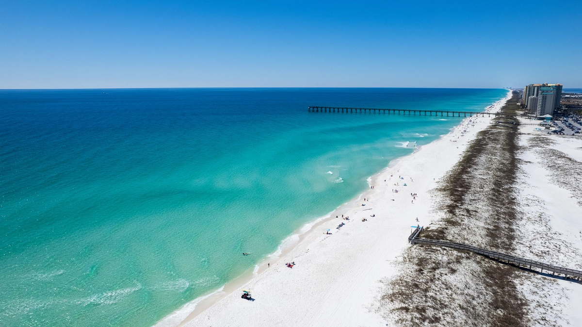
Legend has it that Juan Ponce de León discovered Florida while searching for the Fountain of Youth. While that tale is probably untrue, the lovely southern state certainly feels effervescent with its ocean-scented air and its flourishing, year-round greenery. At least, it feels that way to a Wisconsinite visiting the state after a long winter, which I did this spring, hungry for the promise of warmth and life.
Whether or not he was motivated by the tantalizing tale of water that bestowed unending life, Ponce de León, governor of Puerto Rico and former companion of Columbus, waded ashore on the peninsula around 1513, somewhere near the present-day city of St. Augustine, Florida, the oldest continuously occupied settlement of European origin in the United States. He claimed the land for his king and faith, naming it “La Florida” because he came to it during the Easter season, known in Spain as “pascua florida”—“feast of flowers.”
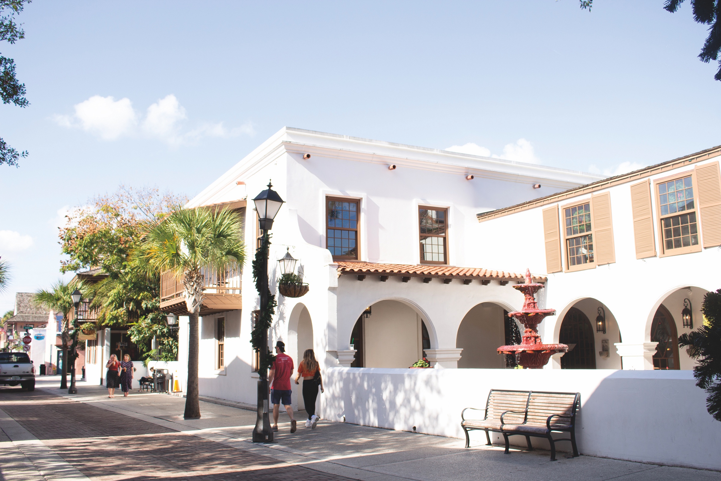
I, too, arrived in Florida with my wife and daughter during the Easter season. This was our second visit to St. Augustine, after our first a few years ago, when the town’s antiquity, beauty, and vibrancy first won our admiration. The historic district of the city resembles a colonial period settlement, and when you walk the winding, Spanish moss-adorned streets—some of which are brick, and all of which reveal their age by their narrowness, built for foot traffic and horses and carts, not cars—the mind naturally roves back over the centuries to those first settlers.
Centuries of History in St. Augustine
Ponce de León’s explorations helped identify Florida as a desirable place for settlement and missionary activity, which gave rise, in time, to the establishment of St. Augustine. That task fell, 50 years after Ponce de León’s activities, to Admiral Don Pedro Menéndez de Avilés, who was sent to secure Spanish holdings in the region and expel French settlers. On September 8, 1565, Menéndez and his water-weary companions landed in a small natural harbor and founded a fort and settlement, named for the saint on whose feast day they had first sighted land. One member of the expedition, Father Francisco López de Mendoza Grajales, recorded the triumphant moment in his diary:
On Saturday the eighth the General landed with many banners spread, to the sounds of trumpets and the salutes of artillery. As I had gone ashore the evening before, I took a cross and went to meet him, singing the hymn Te Deum Laudamus. The General, followed by all who accompanied him, marched up to the cross, knelt and kissed it. A large number of Indians watched these proceedings and imitated all that they saw done.
Then, under an open, wild sky, with ocean winds blowing through the encampment, the same winds that had borne the explorers so many miles from home, Father López celebrated the first parish Mass in what is now the United States. Today, this location is called the Shrine of Our Lady of La Leche, a peaceful patch of parklike greenery under gently rocking palms. Old, sun-blanched gravestones rest among the ferns, bearing names all but worn away by time and nearly lost to memory. In the middle of this place, nicknamed “the sacred acre,” nestles a small chapel, so covered in ivy that it has become a part of the landscape. Inside is a statue of Mary nursing Jesus. The visitor center at the shrine contains an informative and well-run little museum with authentic artifacts that tell of the desperate, early days of settlers and missionaries laboring under the blinding sun and weathering ocean-flung hurricanes, pirates, and British soldiers.
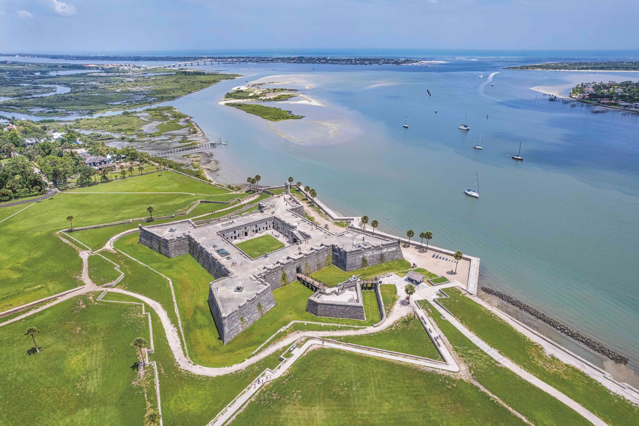
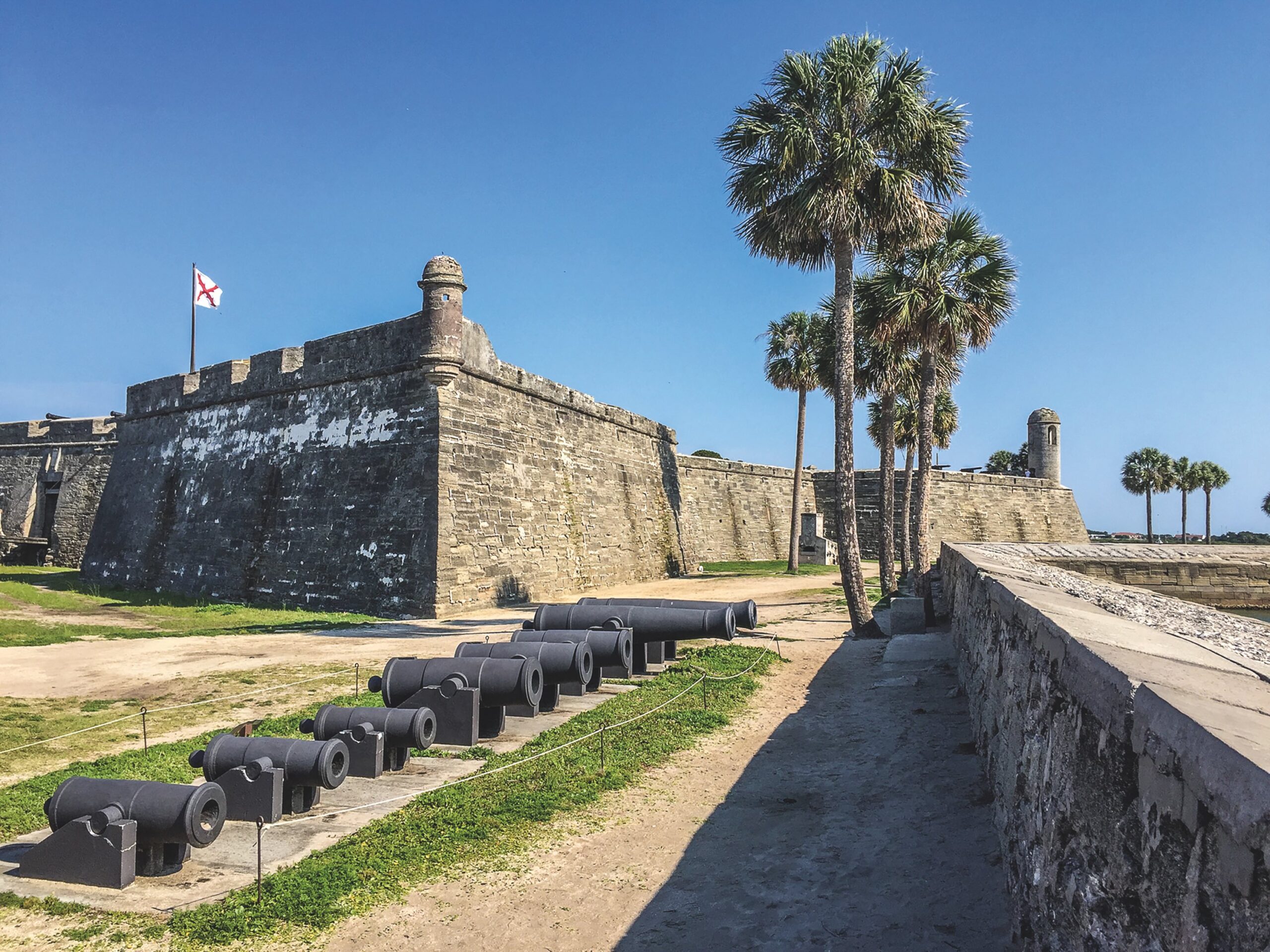
The fort still stands at the edge of town, defying the ocean, looking much as it has these many centuries, impenetrable and unyielding. An art exhibit at the Governor’s House Cultural Center and Museum in downtown St. Augustine revealed many paintings of the fort over the years—a testament to the castillo’s ability to capture the imagination of generations of resident artists. In each picture, even as the town itself grows more modern with time, the fort remains the same.
The fort is well worth a visit. It was built in a star shape, the “bastion system,” to help counter the (then) new technology of gunpowder. The shape could better withstand or deflect incoming cannon balls. Another advantage against cannon fire is that the biological history of the region is embedded in the fort’s walls in the form of “coquina”—a rare type of limestone made up of the shell pieces of ancient mollusks, trilobites, and other invertebrates. The rock’s porous nature better absorbed the shock of a projectile than a more solid material would have. The temporary docking of a full-size, seaworthy replica of one of explorer Ferdinand Magellan’s ships enhanced our experience of the waterfront. The view of the 17th-century fort and 16th-century vessel beside it easily transported us back through three centuries of history until we felt almost as though we had just come to port in a strange new land after treacherous weeks at sea.
Old-World Charm
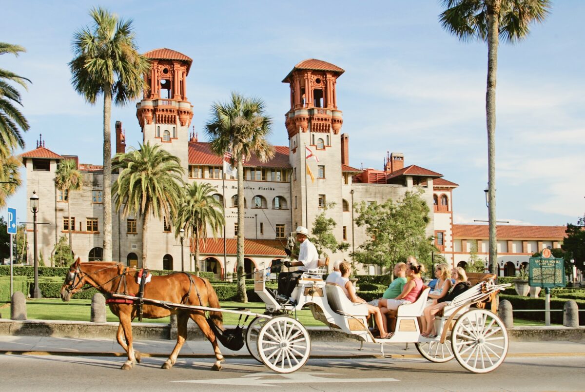
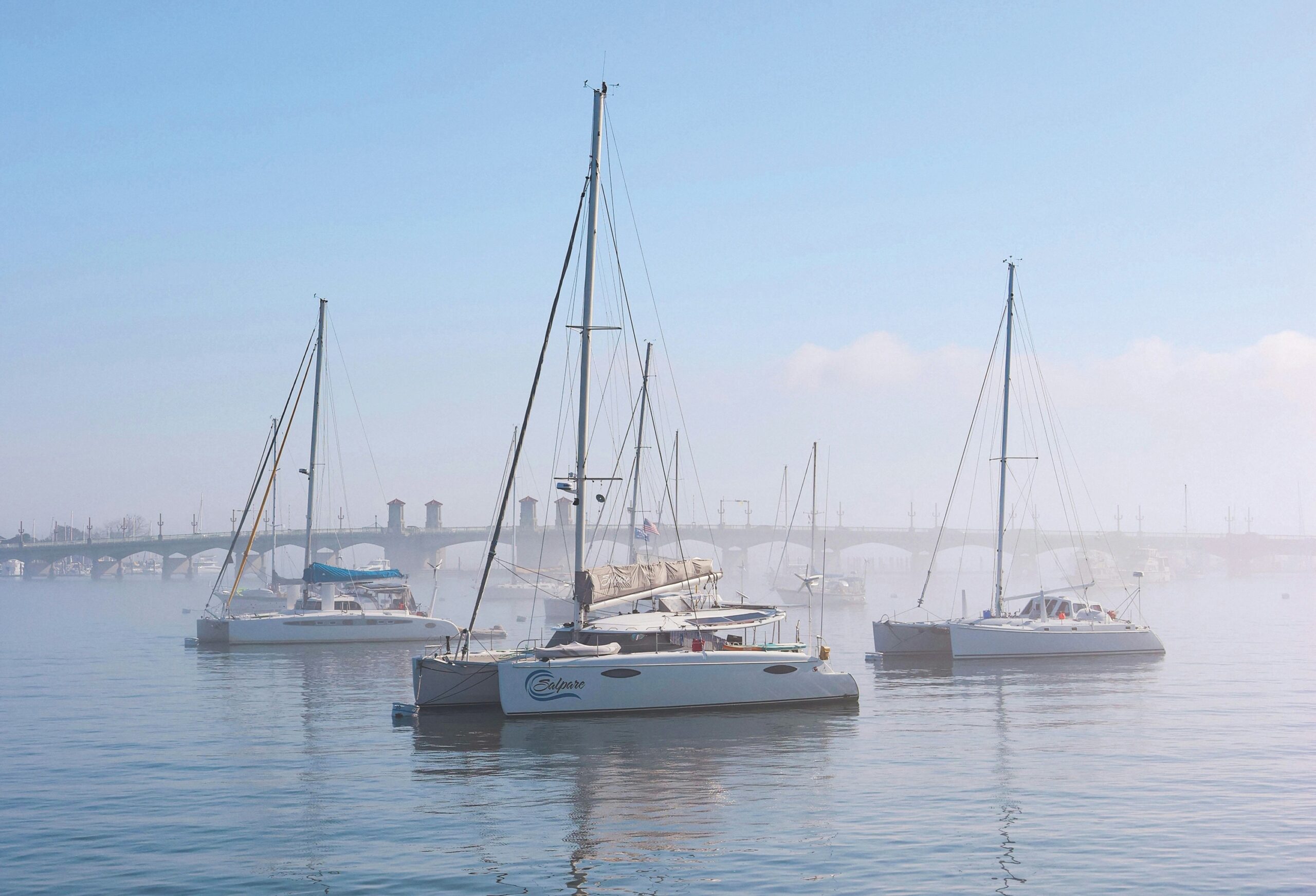
Today, St. Augustine offers a great deal of amenities that our forebears didn’t get to enjoy. Along the waterfront and in the historic district, you’ll find many restaurants, often situated inside old, restored buildings and with ocean views. Old-fashioned wooden signs protrude above the narrow streets, announcing gift shops, galleries, and coffee houses. Half-hidden from passersby, walled-off gardens overflow with lush vegetation while majestic fountains spray water like liquid diamonds into the air of courtyards and plazas beside ornate, 19th-century hotels. The city has the most European feel of any American town I’ve visited.
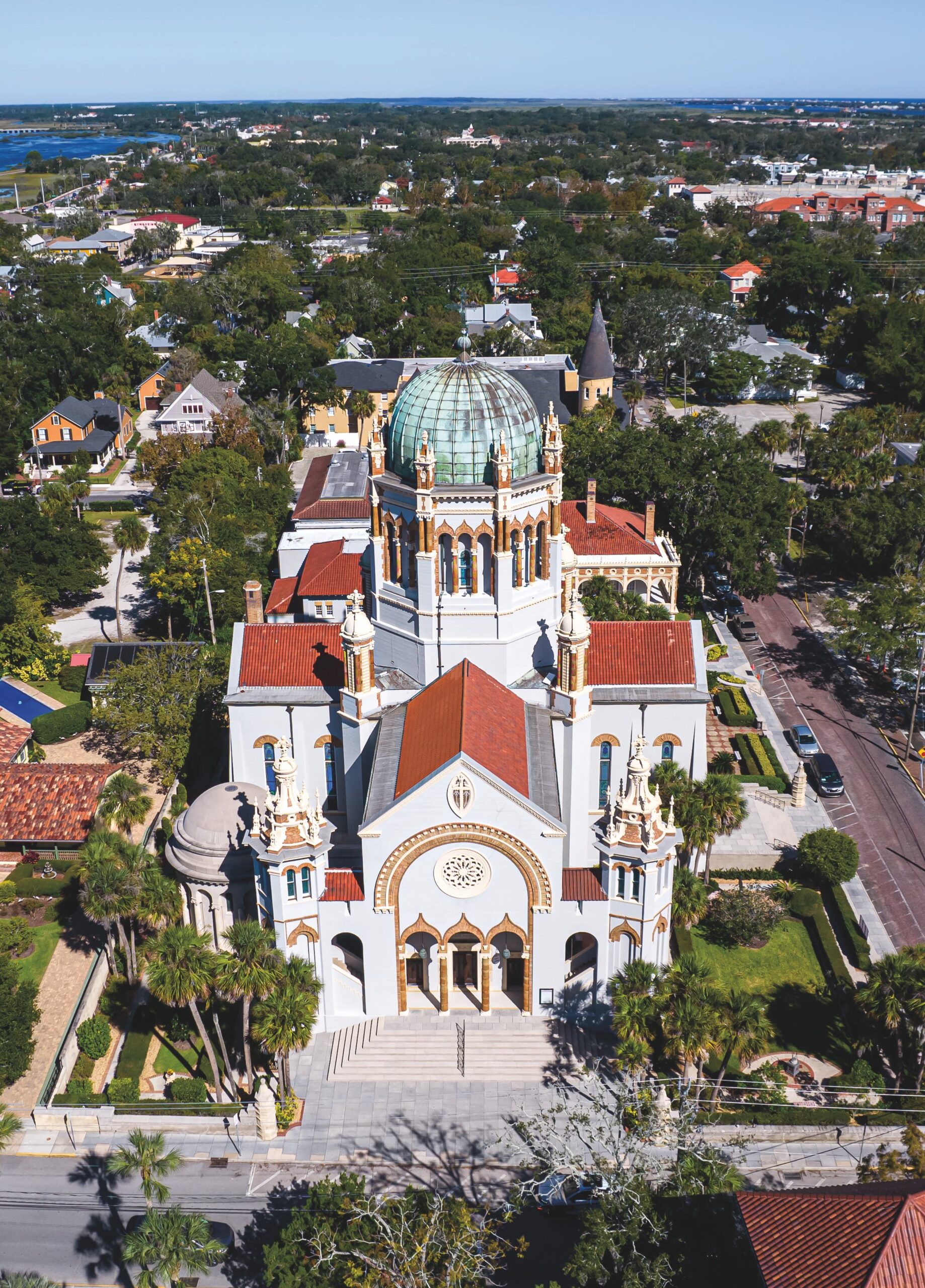
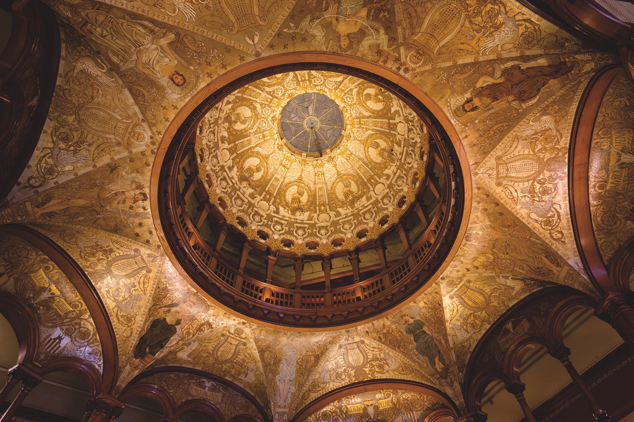
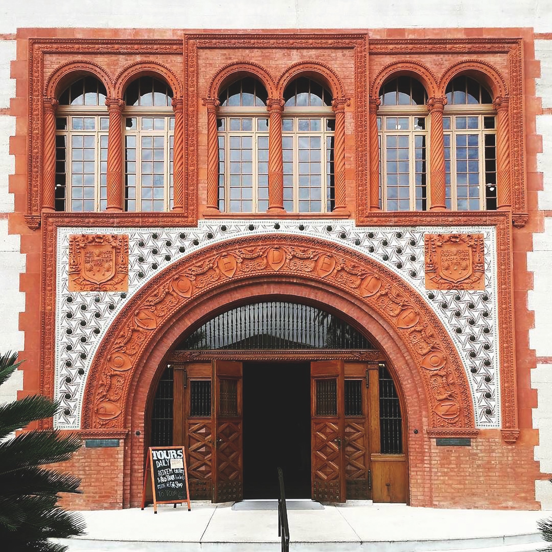
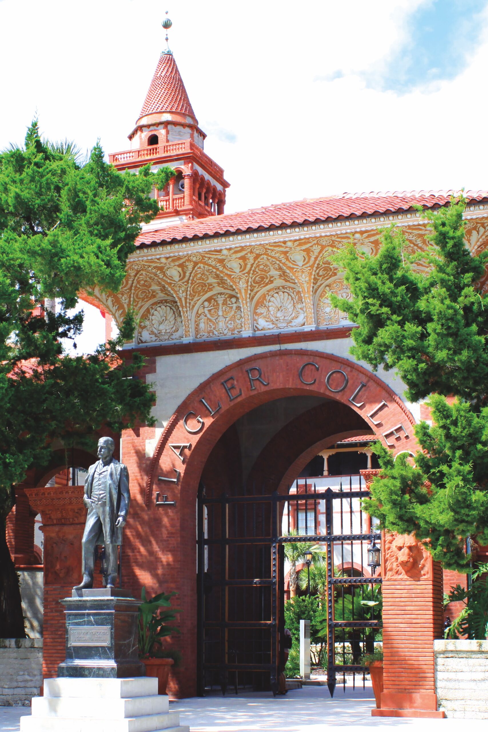
A walk through the Colonial Quarter will take you past the intricate, Spanish Renaissance architecture of Flagler College, the magnificent facade of the Spanish Mission-style Cathedral Basilica, and the twin, red-roofed towers of the Lightner Museum, formerly a Gilded Age resort. Unsurprisingly for the oldest city in the continental United States, there are at least a dozen museums, including the St. Augustine Lighthouse & Maritime Museum, which offers visitors a view of the town and the surrounding beaches at the end of a 219-step climb.
What draws us to St. Augustine? I suppose it is the history, and our old-world sympathies, the serene natural beauty, and the distant crash and stir of the ocean in the background, the waves kissing the shore again and again, running over the sand like the years passing over the city, that draw us to St. Augustine. To me, the city is a link to a deeper past and an older story than most locations in this country reveal. At only 250 years, we’re a young nation, but St. Augustine reminds us of our roots and the inheritance that we carry with us from more than one European nation.
While I stood under the great cross that has been erected where Menéndez first landed and kissed the symbol of his faith, I thought of the early adventurers, wayfarers, villains, and heroes who make up the early history of our country. They couldn’t find the magical Fountain of Youth, but something of their culture and their spirit lives on. Without their story and their struggle, a struggle written into the walls and bricks of St. Augustine, America would not be possible.
From July Issue, Volume IV